Kirishima Mountains Geopark 霧島ジオパーク
The Kirishima Geopark
The Geopark is situated in the region around the Kirishima Mountains (霧島山), southeast in Miyazaki and Kagoshima Prefectures, consisting of more than 20 volcanoes within an area of 600 km2. We walked on moon-like surfaces, with a variety of rock formations in black, yellow, red colours. One of the volcanos, the Shinmoedake (新燃岳) is still active and it became a no-entry zone a few years ago but you can observed its fumes coming out when climbing the top of Karakunidake (韓国岳).
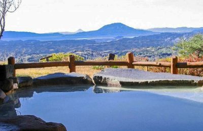
We spent 2 days in the Geopark and made one hike per day. We slept in Kirishima Onsen and took the morning bus to start the hike and the bus back, which was perfectly combinable with the luxury of having great dinner in our Ryokan and soak into wonderful onsens in the evening.
Hike and walk along the Takachihonomine ridge
Takachihonomine (高千穂峰, 1574m) is the second tallest mount in the Geopark. The walk starts from the bus station, Takachiho-Gawara Visitors Center. There is a drinking vending machine there, for the rest take your own food with you. The walk first starts with a steep gravel / stone path the way up. The stones are loose and light and walking becomes difficult and tiring fast. It takes around half hour to ascend, but once you are up, the reward is unimaginable. First you walk along the Ohachi Volcano ridge – a splendid walk with stunning views. After that you connect to the Takachihonomine ridge walk. The total walk does takes 2,5 to 3 hours as showed on the map. Regretfully we didn’t make it until the summit because we had to come back in time for the last bus back. Still it was one of the most impressive walks we ever made.

Map of trail Takachihonomine ridge

Takachihonomine ridge, © Rekalll

Takachihonomine ridge © Rekall

Takachihonomine ridge © Rekall
Legend
In Japanese mythology, the tenson kōrin (天孫降臨) is the descent of Amaterasu’s grandson Ninigi-no-Mikoto from Heaven (Takamagahara) to Ashihara no Nakatsukuni; according to legend, the direct place of descent is at Takachiho-gawara. It is also said that Ryoma Sakamoto, a patriot of the end of the Edo era, and his wife Ryo Narasaki climbed this course together. The summit shows the legendary inverted pike sticking out.
Climb to Mt. Karakunidake for looking at Shinmoedake
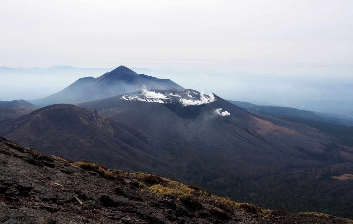
Mt. Karakunidake (韓国岳 – 1700m) is the tallest mount in the Geopark. Depending on the course you choose a loop walk takes around 4-6 hours. The climb starts from the Ebino Plateau bus station. There is a restaurant and a shop. Reaching the peak takes you around 1 / 1,5 hour. From there you have the best possible view on the Shinmoedake, still emitting fumes. After the peak we descended and connected further to the perfectly conic shaped Onami pond trail. The trail goes all around the lake and a loop brings you back to the bus station. This walk was more varied than the moon-like scenery of the Takachihonomine, passing woods, trees, lakes and greenery.

View on the Shinmoedake from Mt. Karakunidake, © Rekall

View on the Onamiike volcano from Mt. Karakunidake, © Rekall

Mt. Karakunidake, © Rekall

Onamiike pond, © Rekall
Practical info
We used the infrequent bus system to bring us to the starting point of our climb. There are only 3 busses per day and for us it worked fine, although renting a car would make you independent from timetables and eventual waiting times, so its up to you. In Ebino Plateau bus station there is a shop where you can buy some food. For all other hikes take lunch with you. You can find the Kirishima trekking map in the Tourist office in Kirishima Onsen in English, but you can study all the courses upfront here. The bus timetable is also printed on it so you can always double check your return.
- Kirishima trekking map
- Wikipedia info Mount Kirishima
- Kirishima Kinkowan National Park
- Other model courses
We last visited in March 2020.