Michinoku Coastal Trail みちのく潮風トレイル

Michinoku Coastal Trail
The Michinoku Coastal Trail is a gorgeous route passing through woods, rivers, beaches, fishing ports and villages. It stretches along the northeastern Pacific coast from the city of Hachinohe 八戸市 to the city of Soma 相馬市, covering more than 1000 km. The trail was built as a contribution to the reconstruction efforts after the 2011 Great East Japan Earthquake. It aims to revive tourism by attracting more visitors to the area. Opened officially in June 2019, Michinoku is the ancient word for the northern Tohoku region.
Trail sections
The trail is sliced in different sections and the official website offers downloadable pfd’s and related info with highlighted points for each of them. The route is linear, from north to south. For loop walks you should use public transport to get back to your starting point. We opted for day hikes with an overnight stay in hotels. We saw 3 sections in total and walked/hiked 3-5 hours per section.
Hachinohe Section
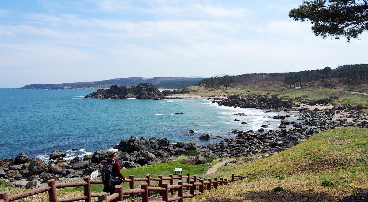
The Michinoku Trail starts officially on the coast of Hachinohe. During weekends it can get quite busy with locals, but most people take short walks or come by car to pick-nick at the Tanesashikaigan Camping Ground 種差キャンプ場. The scenery, colours and the rock formations are splendid. We walked the section from Same Station 鮫駅 to Okuki Station 大久喜駅 and took the train back to Hachinohe. In the afternoon, the train leaves every two hours so plan your return trip accordingly. While waiting we pick-nicked a bit further down the road, overlooking the sea. Check here the detailed map for the walk. For your resting moments, we recommend to stay at one of our favourite hotel brands, the Hon Hachinohe Dormy Inn Hotel.

Hachinohe section of the Michinoku Coastal Trail, © Rekall

Hachinohe section of the Michinoku Coastal Trail, © Rekall

Hachinohe section of the Michinoku Coastal Trail, © Rekall

Hachinohe section of the Michinoku Coastal Trail, © Rekall
North to Central Miyako Section
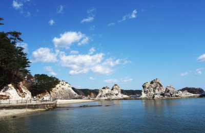
For this section we left our luggage in Morioka 盛岡市 and travelled by bus to Miyako Station 宮古駅. There we switched to another bus going to Furusato and walked 30 mins descending to the coast. Another alternative would be to take the bus to Nakanohama, check on google maps which options are more attractive according to timetables. Our walk started officially at point nr. 5 of the section at the Tsunami Memorial Park in Nakanohama 震災メモリアルパーク中の浜 and ended at point nr. 10, at Jodogahama beach 浄土ヶ浜. Official trail info here.
In general, this walk is more demanding than the beginner’s Hachinohe section and hiking shoes are a must. The path follows the rugged coastline with steep cliffs and goes up and down passing through forests, small rivers and fishing ports. There are some nice viewpoints. We didn’t meet any other hikers on our way and the day was splendid. Be sure to take food with you as we didn’t come across any shops until our arrival spot Jodogohama beach. Our hotel was just 5 minutes up the hill, so after enjoying the beautiful beach and buying a snack at the rest house, we headed to the hotel for the deserved rest. For us this was by far the wildest and most interesting of the 3 walks we did.

Tsunami Memorial Park at Nakanohama, © Rekall

Miyako section of the Michinoku Coastal Trail, © Rekall

Miyako section of the Michinoku Coastal Trail, © Rekall

Miyako section of the Michinoku Coastal Trail, © Rekall

Miyako section of the Michinoku Coastal Trail, © Rekall

Miyako section of the Michinoku Coastal Trail, © Rekall

Miyako section of the Michinoku Coastal Trail, © Rekall

Miyako section of the Michinoku Coastal Trail, © Rekall
Kamaishi Section
For this section we took the train from Miyako to Ryōishi Station 両石駅, one station before Kamaishi 釜石市, and started to walk from there. The walk itself is less advisable because part of the route goes along a busy traffic road. It’s maybe better to head directly to Kamaishi and visit the town itself. You can check the Iron and Steel History Museum or walk up the hill and visit the Kamaishi Dai-kannon Temple for great views of the bay. Besides this, Kamaishi has not much to offer except its sad history – this small industrial port town was completely devastated by the tsunami in 2011 and rebuilt in the following years.

Kamaishi city, view from the Dai-kannon Temple, © Rekall

Kamaishi city, view from the Dai-kannon Temple, © Rekall
Note on the 2011 tsunami
Tsunami Memorial Park at Nakanohama
The Tsunami Memorial Park at Nakanohama was a good starting point for us to understand the gravity of nature disasters. The area was previously a camping ground and the tsunami swept everything away but some concrete facilities. Waves reached 21 meters in height. You can witness photos of different cities during and after the disaster and read explanations about tsunamis in general.

Tsunami Memorial Park at Nakanohama, © Rekall

Blue sign on the hill right showing 21 meters high waves. Tsunami Memorial Park at Nakanohama, © Rekall

Explanatioins about tsunamis at the Tsunami Memorial Park in Nakanohama

Explanatioins about tsunamis at the Tsunami Memorial Park in Nakanohama
Obstructed nature
While passing by the coast we saw huge concrete reinforcements sometimes completely blocking the view of a beach. These structures aren’t beautiful, however they represent the heavy reliance of Japanese society on technology to counteract adverse effects of natural phenomena.

Concrete reinforcements along the Miyako section of the Michinoku Coastal Trail © Rekall

Concrete reinforcements along the Miyako section of the Michinoku Coastal Trail © Rekall
Kamaishi and Miyako
Many villages by the sea were hit by the tsunami that followed the earthquake, Kamaishi and Miyako being among the ones most hardly damaged. The port side of Kamaishi was as such completely rebuilt. Climbing the hill on the way to Dai-kannon Temple we also noticed many areas with tumuli. Later we found out these are storages for radioactive debris.

Kamaishi port, view from the Dai-kannon Temple, © Rekall

Images of Miyako during Tsunami 2011, photo taken at Tsunami Memorial Park in Nakanohama

Images of Miyako during Tsunami 2011, photo taken at Tsunami Memorial Park in Nakanohama
Practical info
While walking in some more forested areas we noticed warning signs of bear habitat. To be at ease, always take a bear bell with you and attach it on your bag. The bell will produce sounds while walking that will eventually warn the animals of your arrival and give them enough time to hide.
- Official website of the Michinoku Coastal Trail in English
- Hachinohe Section course description (from official website)
- Hachinohe Section map (from official website)
- North to Central Miyako Section course description (from official website)
- North to Central Miyako Section map (from official website)
- Facebook group Michinoku coastal trail
Last visited in 2019.


