

Hiraodai karst hike
平尾台
A walk across Hiraodai, the karst plateau above Kitakyushu, over open grassland scattered with thousands of white limestone rocks.
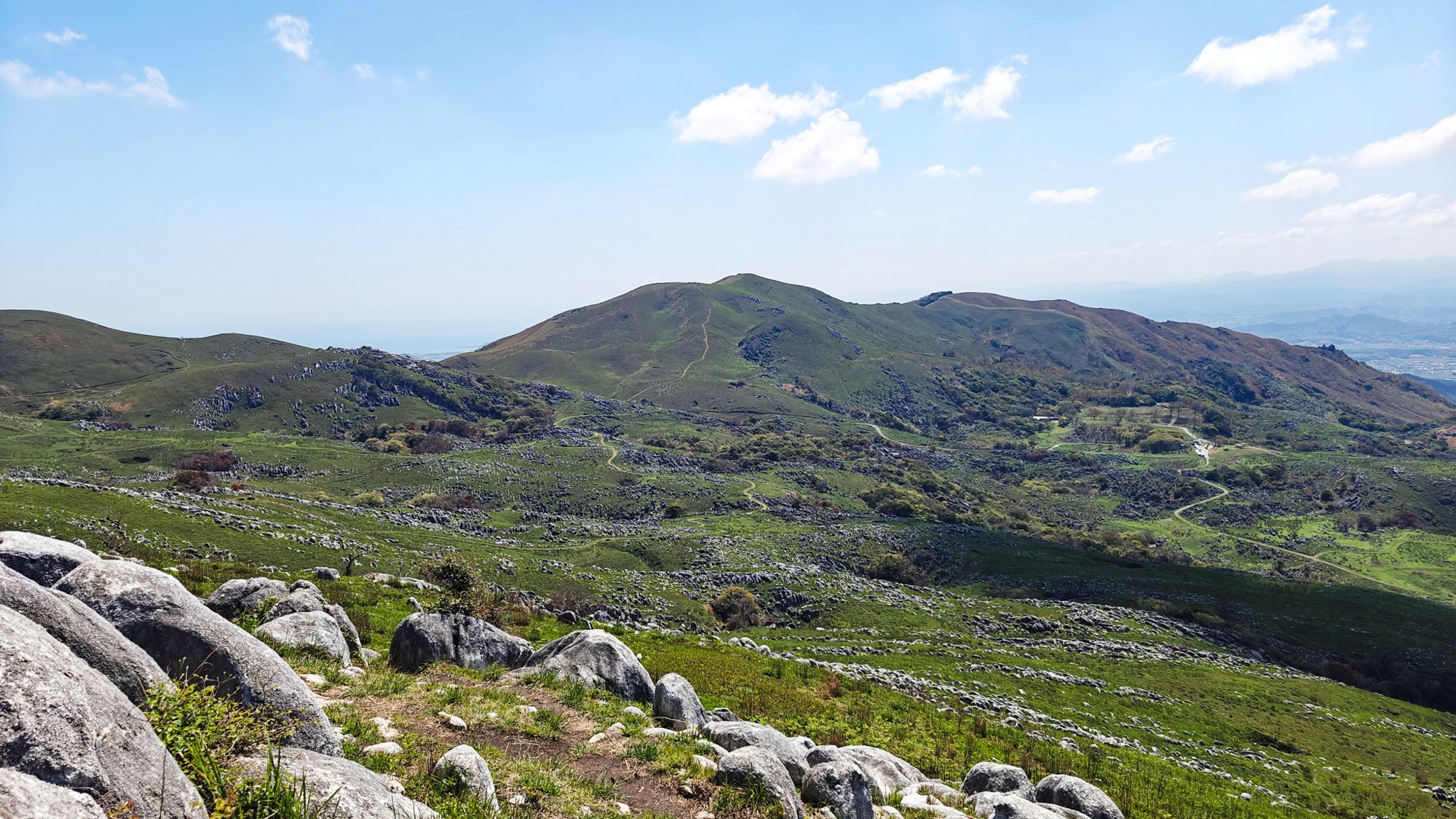
One of Japan’s three great karsts
Hiraodai is a limestone plateau on the hills behind Kitakyushu, 6 km north to south and 2 km east to west, lifted between 370 and 710 m above the city. It has been a national natural monument since 1952, and counts as one of Japan's three great karsts alongside Akiyoshidai and the Shikoku Karst. The other two sit deep in the mountains. Hiraodai is half an hour from the middle of Kitakyushu, the industrial north of Kyushu — not where you would expect to find a plateau of open grass and white rock.
The plateau is burned off in a controlled fire every spring, so there is open grass instead of forest and nothing blocking the view. Out of it stand thousands of white limestone rocks, in places so dense the hillside looks paved. You can see where you are going all day.
Up from Fukiage Pass to Shihodai
From the parking at Fukiage Pass the path goes straight up onto the grass, over Ōhirayama (大平山) and then east along a broad ridge. Each rise gives onto another one, and every hill is ringed and studded with the same weathered white rock.
An hour in we were on Shihodai (四方台, 619 m), a wide flat top where a four-way signpost points on to Mount Nuki, Nakatoge Pass (中峠) and back to Ōhirayama. From here the ground drops away north-east toward the coast and you get your first proper sense of how high the plateau sits above the plain.



Mount Nuki, and the whole of Kitakyushu below
Twenty minutes north of Shihodai the ridge lifts to Mount Nuki (貫山, 712 m), the high point of the plateau. Kitakyushu lies directly below, the port and its cranes running out into the bay; beyond it the sea, then the tip of Honshu and Shimonoseki across the strait. On a clear day it reads like a map, and it is unusual to get a view over a city of a million people from a hill you have walked up through grass.


South along the ridge to Suhodai
Rather than turn back we went south, retracing the ridge past Shihodai and then on down the spine of the plateau. This is the best walking of the day: a thin brown path over one grassy dome after another, visible far ahead, with limestone reefs breaking through the slopes on either side and the quarry workings on the far edge as a reminder of what the rock is worth.
Suhodai (周防台) is the last of the tops, 606.5 m according to the small blue sign, an hour of easy ridge from the summit. A few people were out in the grass picking, and we passed others on the main paths, but it never felt busy.


Yōgunbaru, the sheep-flock plain
The way back drops west off the ridge and into the rock fields the plateau is known for. They are called Yōgunbaru (羊群原), the sheep-flock plain: from a distance the rounded, pale blocks standing in the green really do read as a scattered flock at pasture.
Close up they stop looking like sheep and start looking unreal. Rain has cut the limestone into fins and flutes, so each block is grooved from the top down like melted wax, and they stand in loose rows following the bedding of the rock. It is worth slowing down here rather than walking straight through; it is the strangest ground on the plateau and the last stretch before the path returns to Fukiage Pass.


After the walk
We drove on along the plateau road afterwards and had a late lunch at the visitor park further up.
Good to know
- Getting there
The walk starts from the Fukiage Pass (吹上峠) parking lot, about 40 spaces, with a toilet. Best way is to come by car. There are no shops, vending machines or water on the plateau. Bring your own food and drink.
- Route & difficulty
Our loop was 10.0 km with about 580 m of ascent and 3 h 23 min in total. The signposted short version — Fukiage Pass, Ōhirayama, Mount Nuki, Chagatoko and back — is about 8.4 km and 3.5 hours.
Easy to moderate: grass and earth paths throughout, no scrambling, but the ups and downs are constant and the limestone edges are sharp underfoot in places, so wear proper shoes. There is no shade anywhere on the plateau — take a hat, sunscreen and water.
- Season
We walked it in mid-April, with the short new grass and clean rock that follow the winter burn. The grassland is burned off in late February and roads on the plateau close on burning day — check the Kitakyushu city pages if you are travelling then.
- Nearby
The caves. Hiraodai has over 200 caves, three of them open to visitors: Senbutsu (千仏鍾乳洞), a national natural monument with 900 m lit and a stretch you wade through, plus Mejiro (目白鍾乳洞) and Oshika (牡鹿鍾乳洞). They are separate paid attractions off the plateau road; we did not go in.
Lunch. Soraland Hiraodai (ソラランド平尾台 / 平尾台自然の郷, signposted as Hiraodai Countryside Park) has a café-restaurant, Yama no Toraya (山のとらや) — we had the very good Miyazaki beef hanbāgu. Parking ¥300.
- Official links
- GPX track
-
Download the GPX track of Hiraodai karst hike, for your maps app or GPS watch.
- Location
-
Hiraodai, Fukuoka Open in maps (external link)
- Details
-
Visited Last checked