Kankakei Gorge hike up to Mount Hoshigajo
寒霞渓
A full-day hike up through Kankakei to the highest peak in the Seto Inland Sea
Kankakei gorge
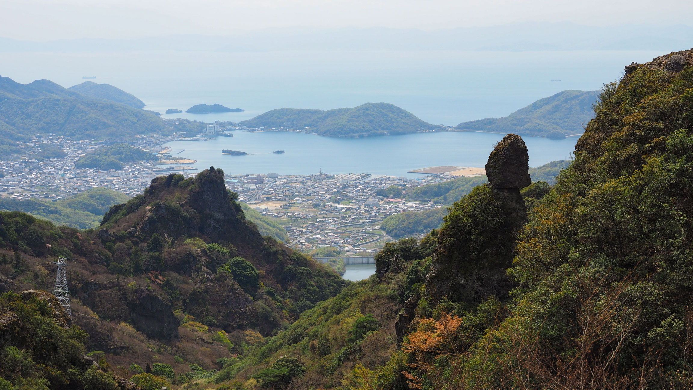
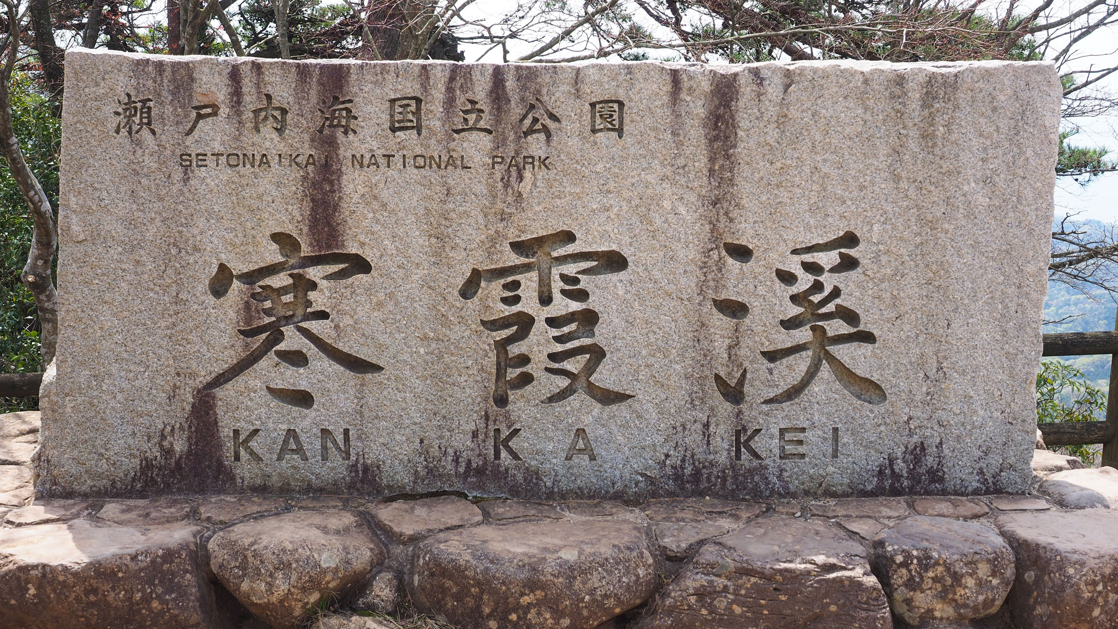
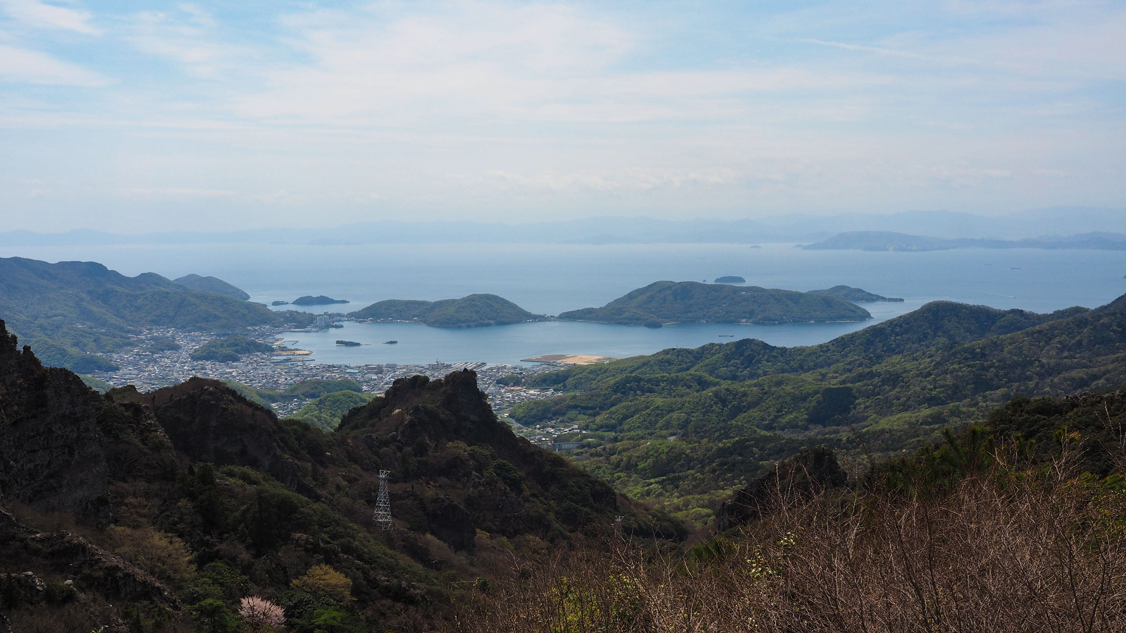
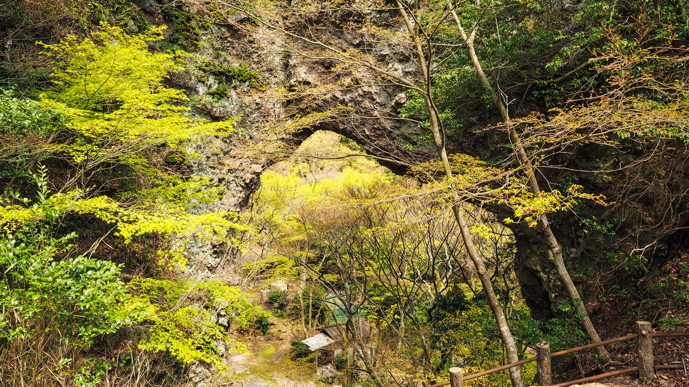
Kankakei is Shodoshima's mountain heartland — a steep valley carved by the Kankakei River through ancient volcanic rock, with forest, maple trees and sheer cliff faces rising on either side. It is counted among Japan's three most beautiful gorges and sits within Setonaikai National Park. Despite the name, hiking here means climbing up through forest and past rock formations rather than walking along a riverbank — the trails gain real elevation, eventually reaching the summit and beyond. Most visitors arrive by ropeway and spend an hour at the top before heading back down. Going on foot is a different experience altogether: quieter, more textured, and with the landscape revealing itself gradually as you climb.
The hike to the summit
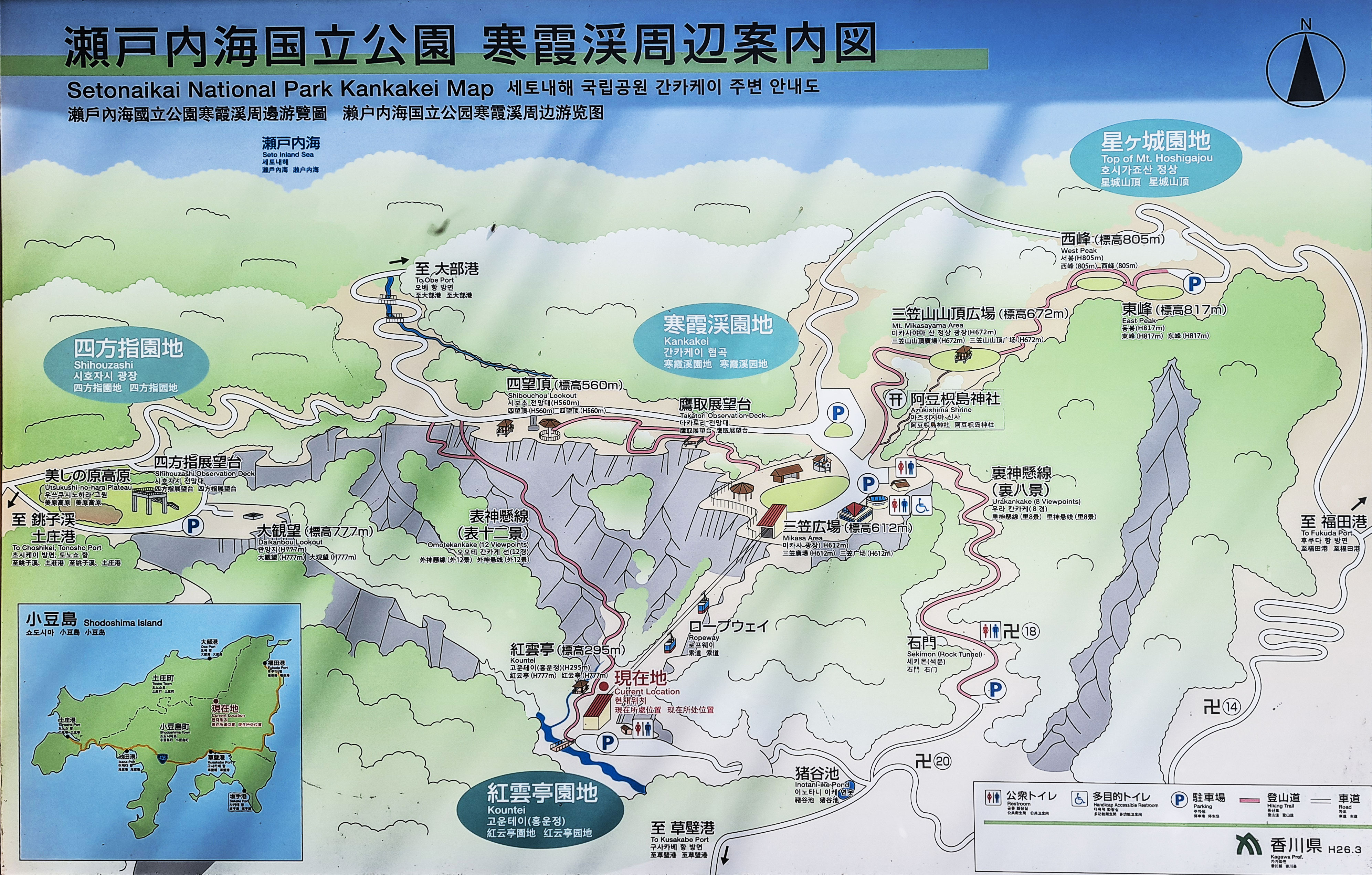
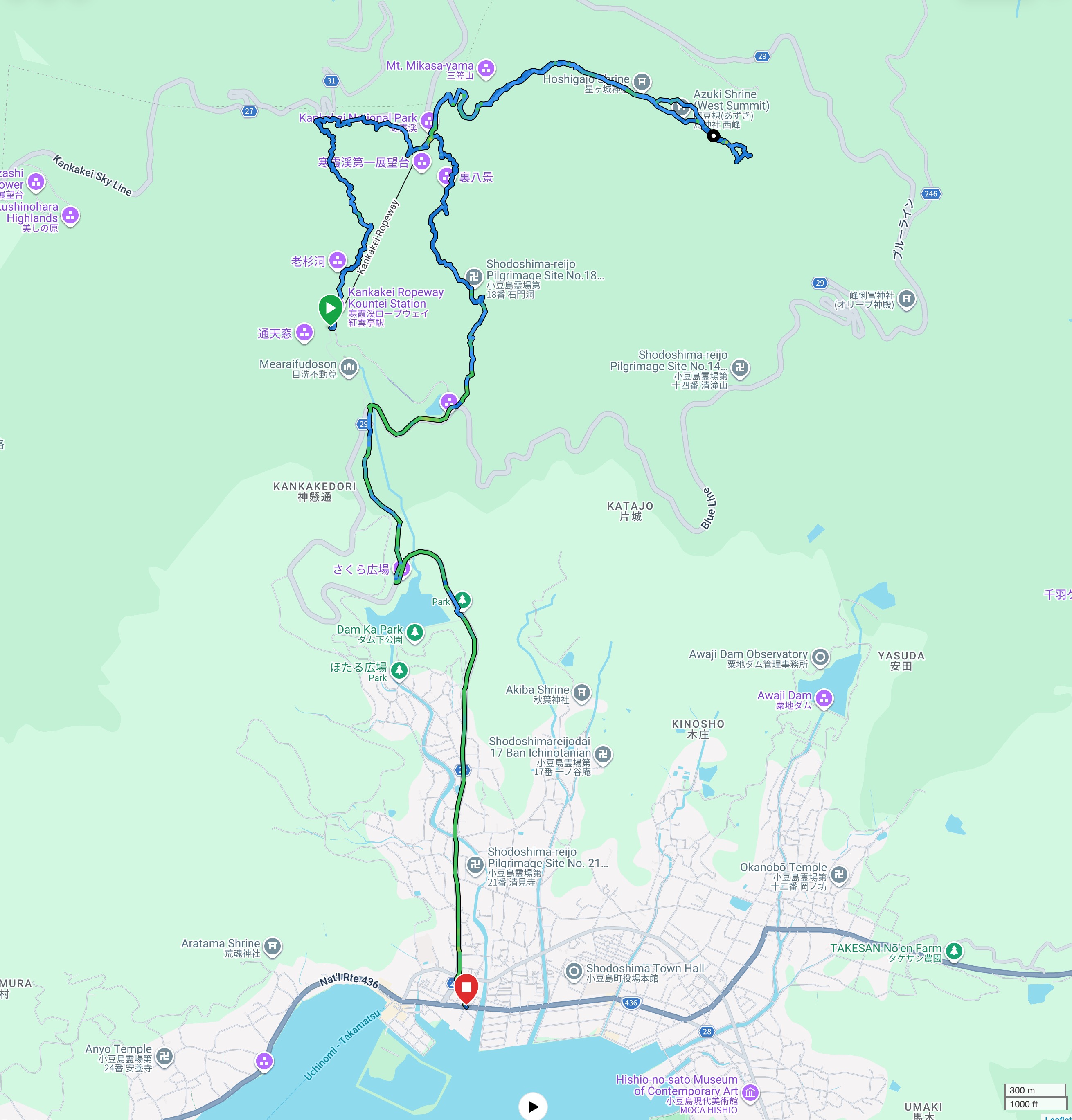
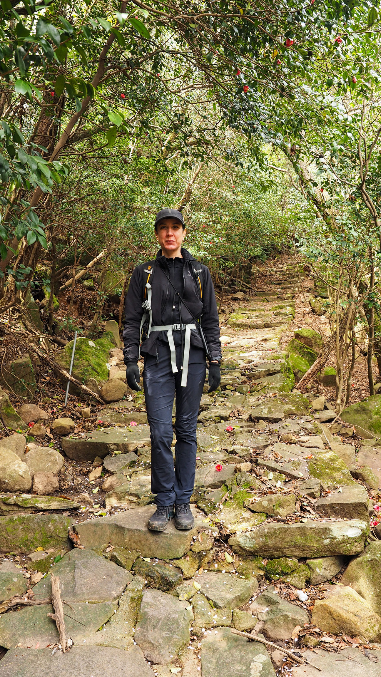
The starting point is the Kouuntei bus stop (紅雲亭), where the lower ropeway station is also located. The lower station sits at 295 metres elevation, and from here two hiking trails lead up to the summit — the Omote 12 Views trail and the Ura 8 Views trail. We opted for the Omote 12 Views route: well-maintained and easier to follow on the ascent. It took us roughly an hour to reach the top.
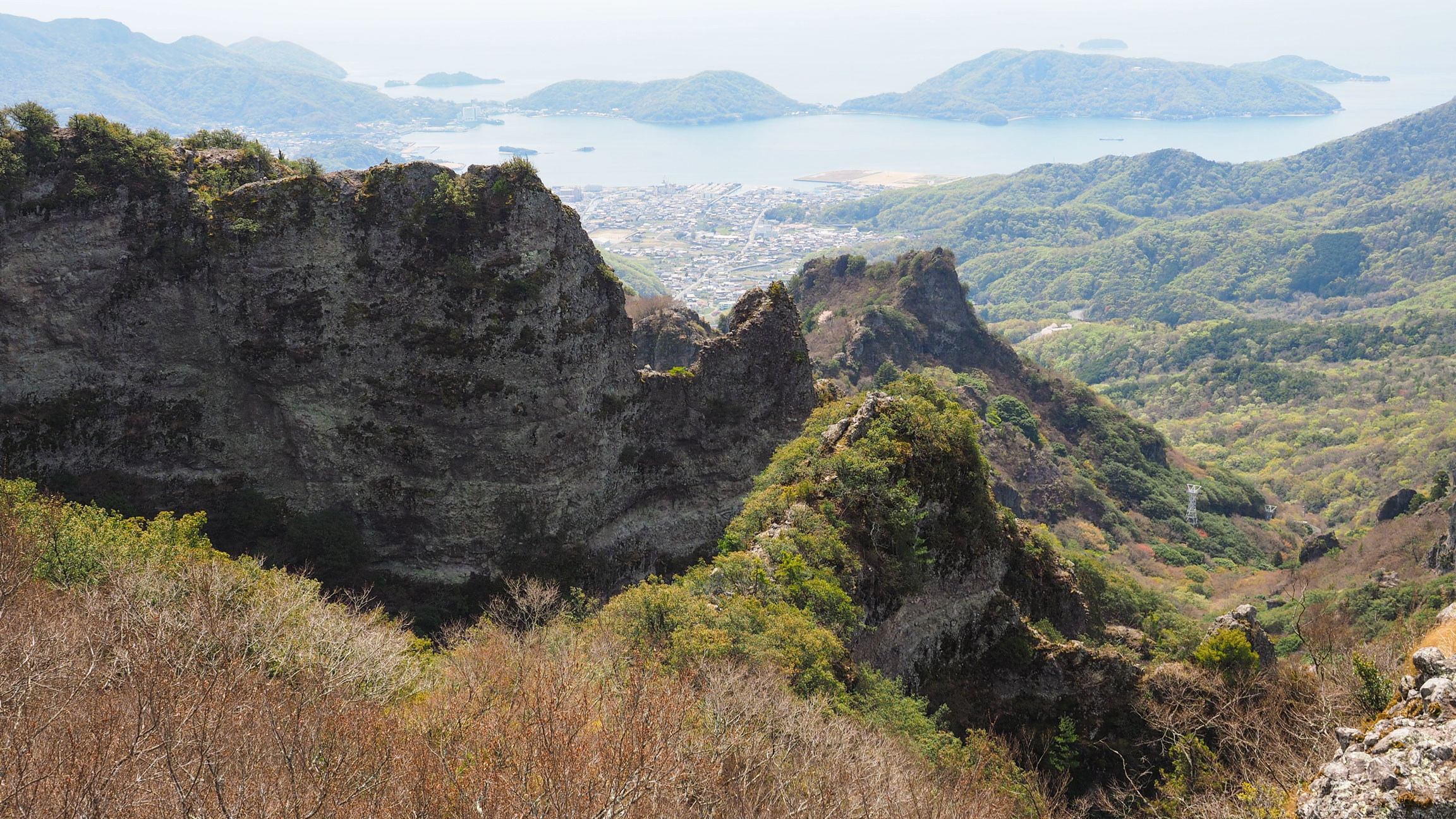
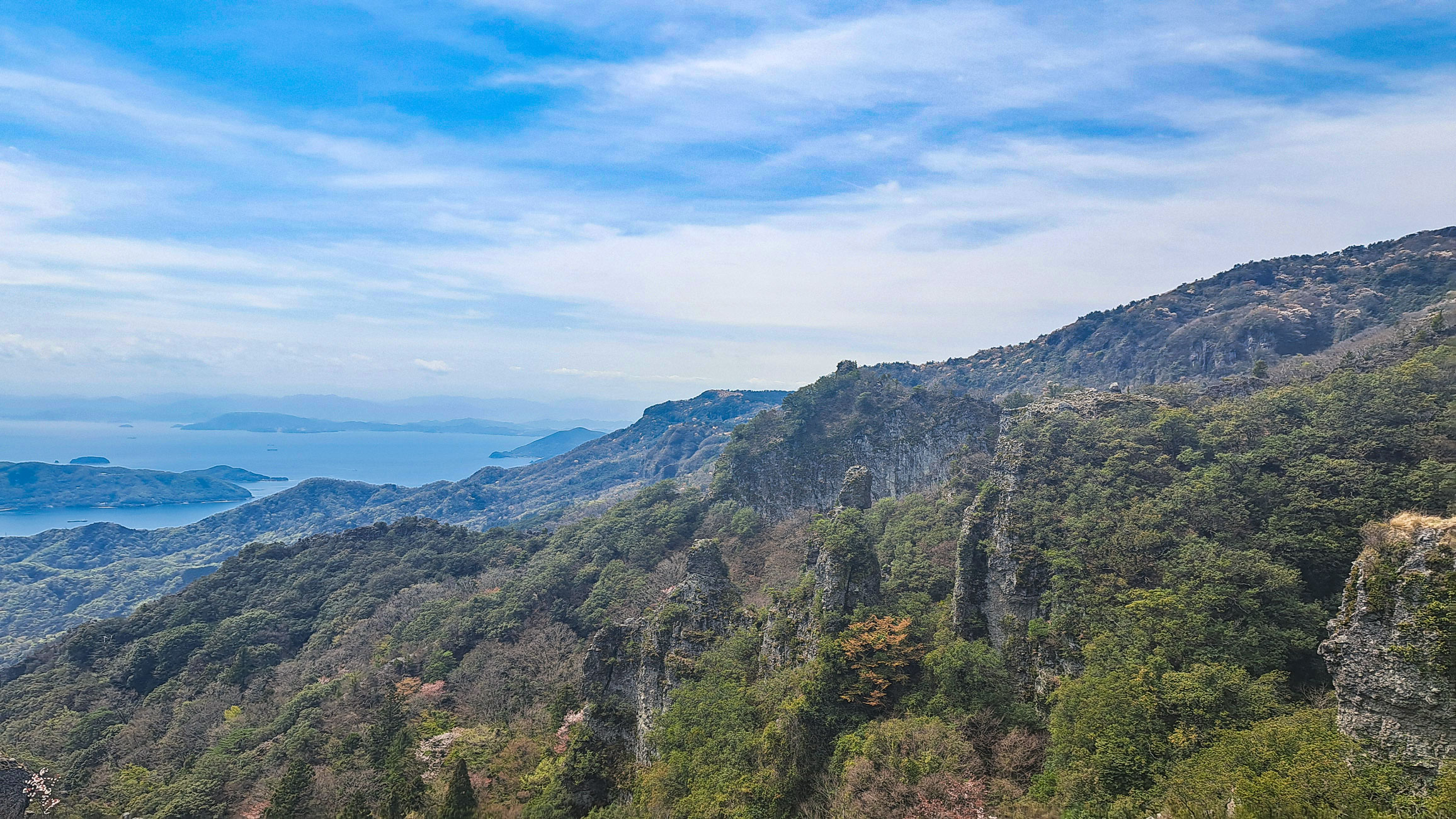
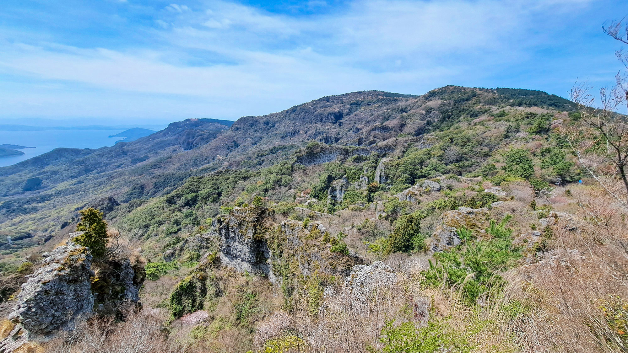
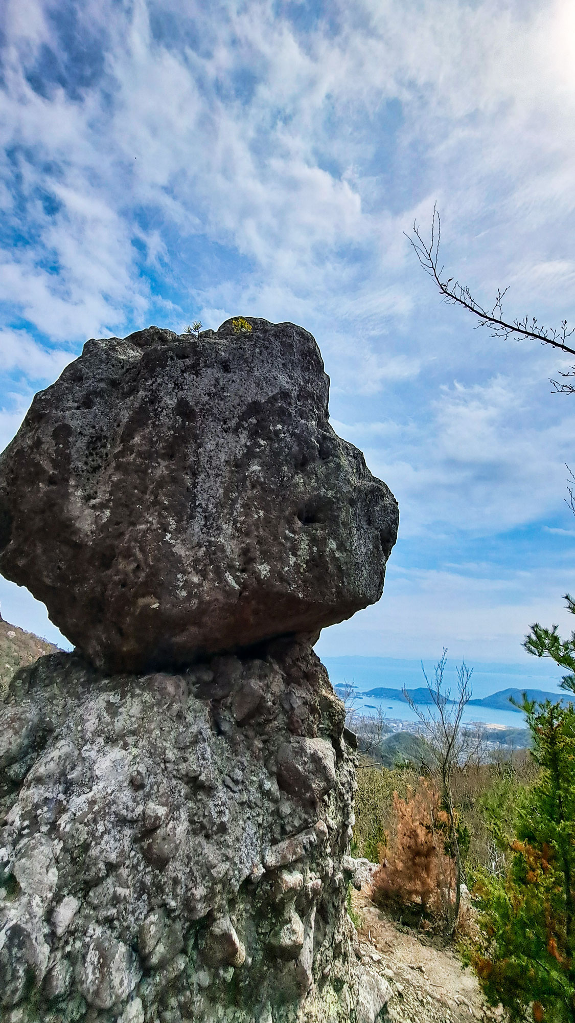
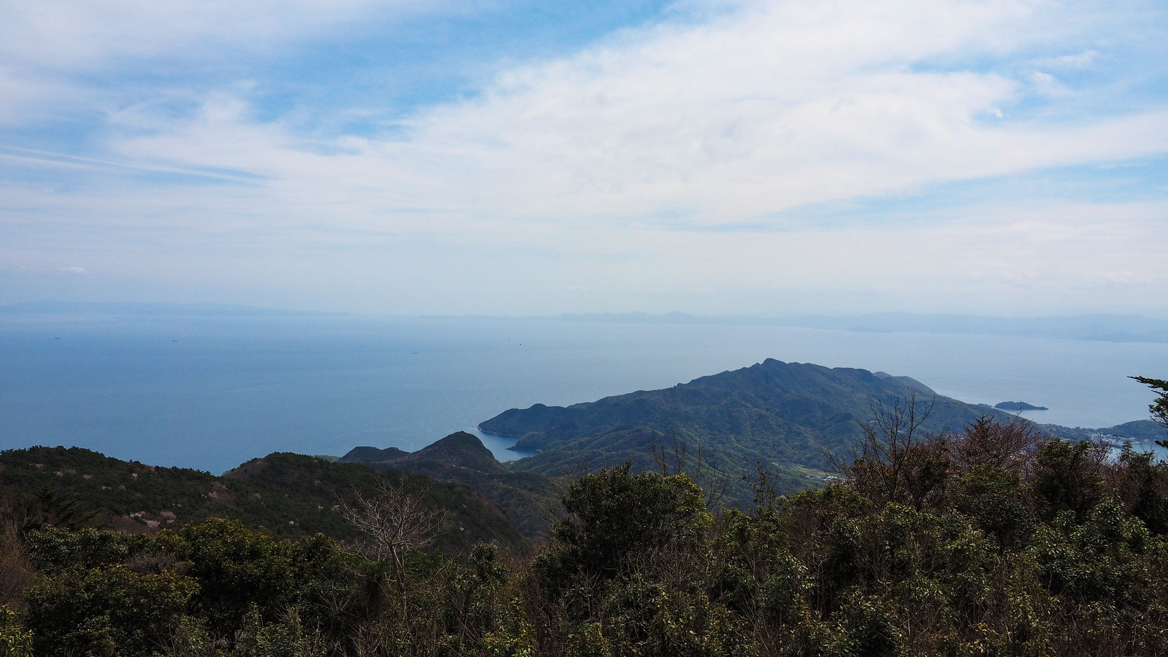
The trail climbs steadily through forest and past the gorge's distinctive rock formations — volcanic andesite sculpted over millions of years into strange, angular shapes. The higher you go, the more the trees open up and the Seto Inland Sea comes into view between the ridges.
The ropeway summit station sits at 612 metres and has observation decks, a restaurant and souvenir shops. It gets busy, particularly with bus tour groups arriving by ropeway. If you continue past the summit area and head toward Mount Hoshigajo, the crowds thin out almost immediately.


From the summit to Mount Hoshigajo
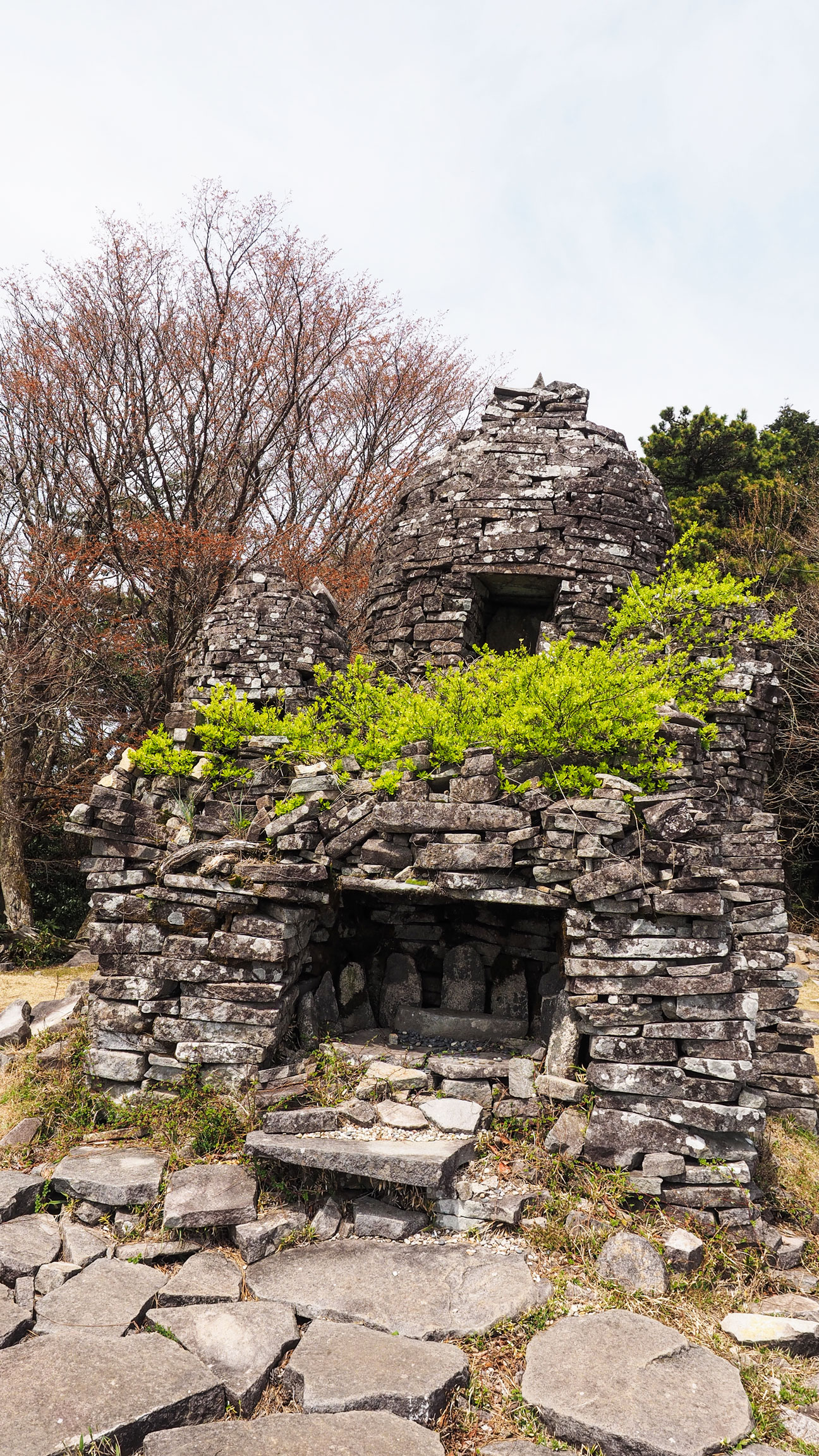
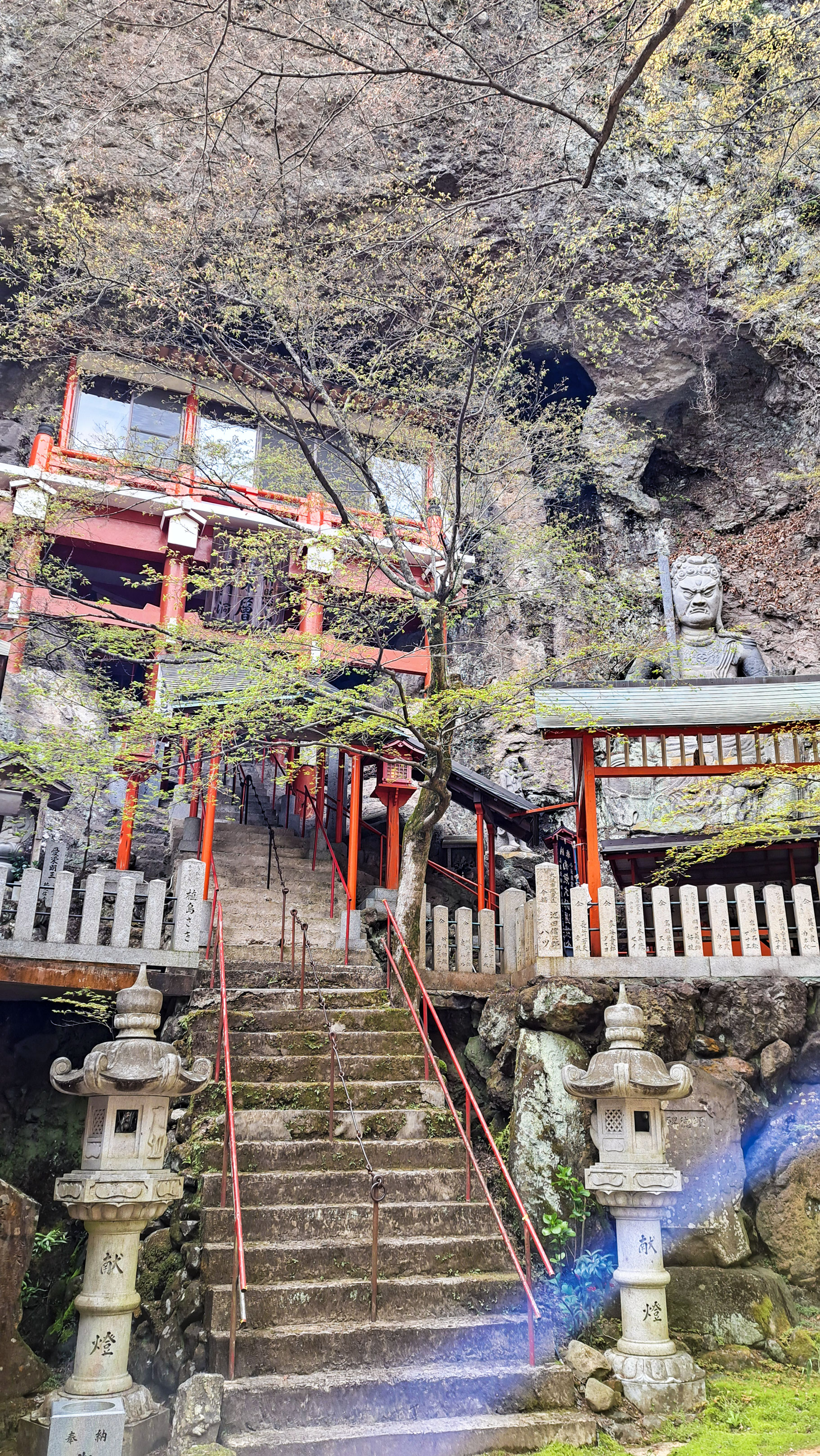
Beyond the ropeway summit, a trail continues upward through thick cypress forest toward the two peaks of Mount Hoshigajo. The entrance is through a torii gate, easily visible from the summit area, and the trail passes several small shrines on the way up. We passed through Azukishima Shrine on the West Peak at around 805 metres — it enshrines Onudehime, the spirit of the island, and according to ancient myths recorded in the Kojiki, Shodoshima — known then as Azukishima — was the tenth of the Japanese islands created by Izanagi and Izanami.
From there it's a short push to Mount Hoshigajo at 816 metres, the highest peak in the Seto Inland Sea. The views from the top are tremendous — on a clear day you can see across to Shikoku, the Naruto strait and Awaji Island beyond.
This upper section is where the hike earns its length. The forest is dense and quiet, with very few other people once you leave the ropeway area behind. The whole route — from Kouuntei up to the summit, across to Hoshigajo and then down the other side — came to 13.6 km and took us about four hours, with 633 metres of ascent.
The way back
We didn't retrace our steps. Instead we descended via the Ura 8 Views route. This route felt closer to untouched nature. Once we reached the trail end point, we continued along the asphalt road, passing the Uchinomi Dam and walking through the outskirts of town before catching the bus back at Kusakabehonmachi (草壁本町). The return route will depend on where you're staying — we needed to get back to Tonosho, so this worked well. If your hotel is on the Kusakabe side of the island, you'd have options that are shorter or more direct.
Good to know
- Getting there
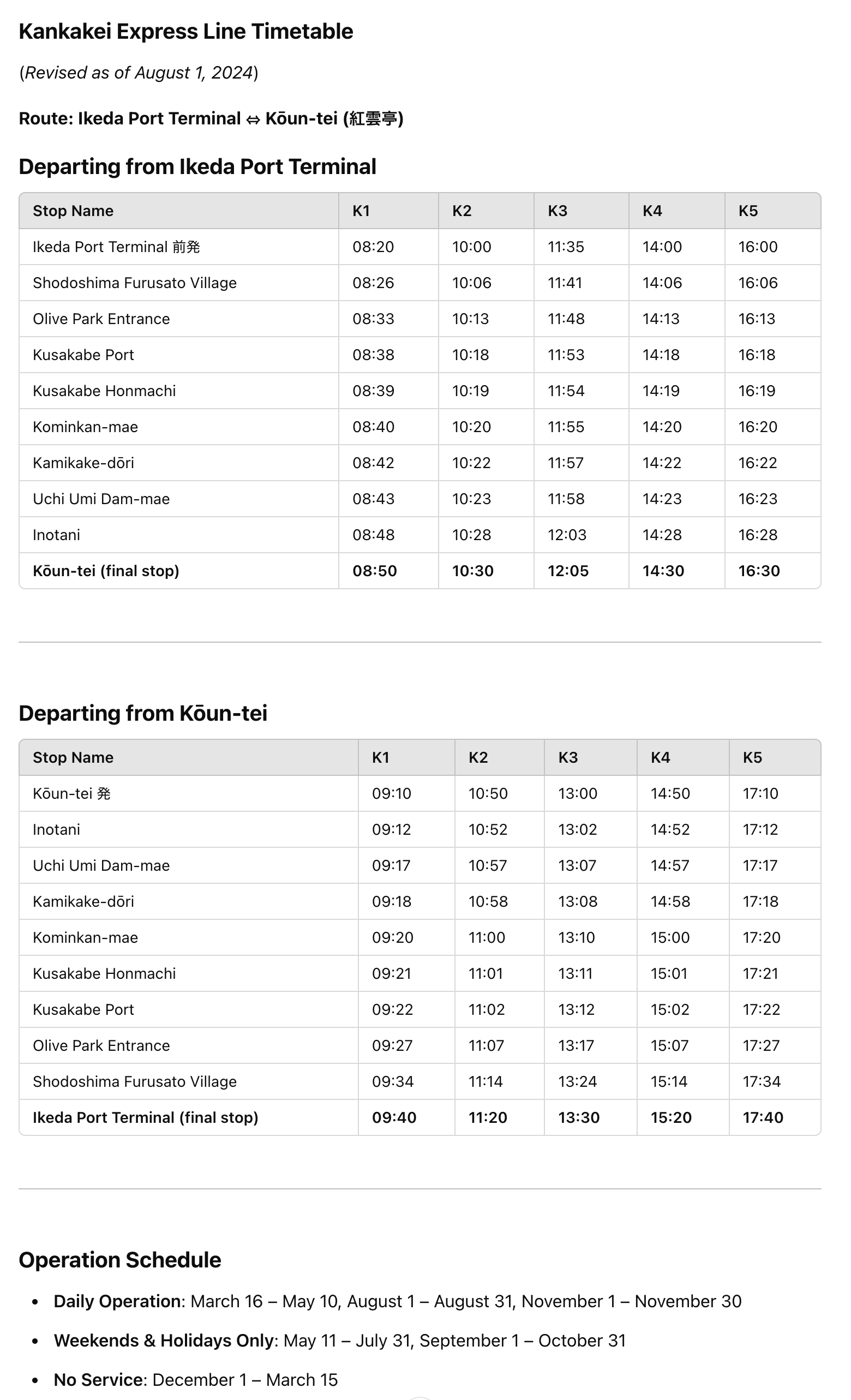
Take the Shodoshima Olive Bus from Tonosho Port toward Kouuntei (紅雲亭) — the journey takes about 1 hour 18 minutes. Check the Shodoshima Olive Bus timetable (external link) before you go, as services are limited and some routes run seasonally
- Getting back
We returned via Kusakabehonmachi (草壁本町) bus stop after descending through the Uchinomi Dam area. Route will depend on your accommodation — check options at the summit before you descend
- Links
- GPX track
-
Download the GPX track of Kankakei Gorge hike up to Mount Hoshigajo, for your maps app or GPS watch.
- Location
-
Shodoshima Open in maps (external link)
- Details
-
Visited Last checked