Walking the Mount Usu crater trails at Lake Toya
洞爺湖 - 有珠山
A volcanic landscape walk through the Mt. Usu eruption zone with crater ponds, broken roads and abandoned buildings
The Toya-Usu UNESCO Global Geopark
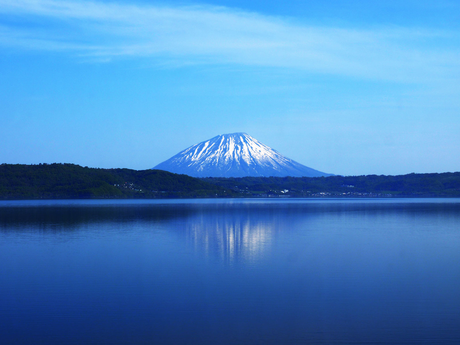
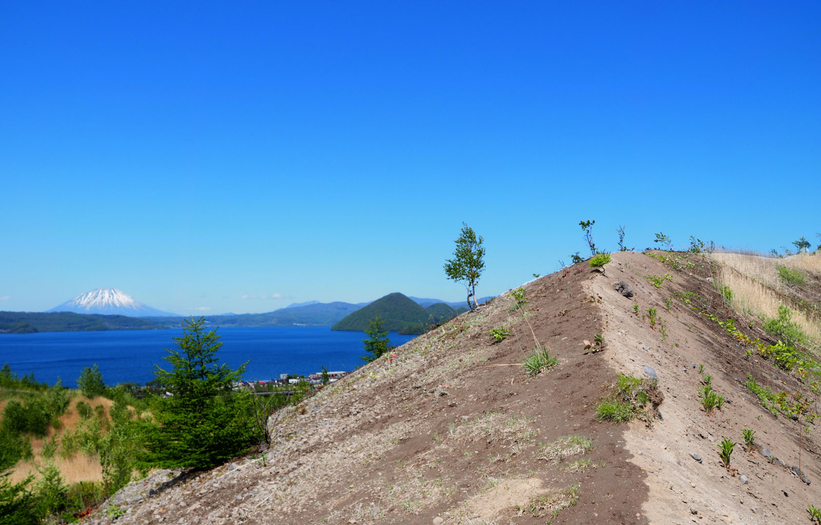
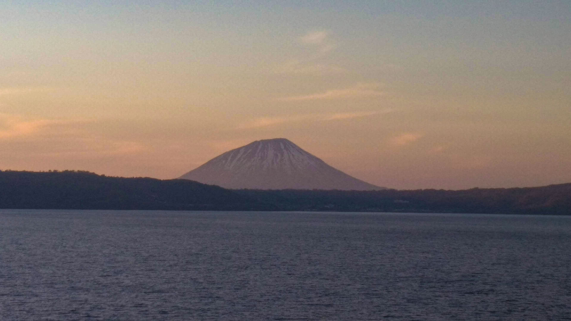
Lake Toya fills a caldera that formed in a massive eruption about 110,000 years ago. Mount Usu, the much younger stratovolcano on its southern shore, only began forming some 10,000 to 20,000 years ago, and has erupted at least nine times since 1663, four of them in the 20th century alone, most recently in 2000. In 2009 the area became Japan's first UNESCO Global Geopark, and it now covers volcanic landscape trails, forest and city trails, and a number of history and culture routes around the lake.
The closest trails within walking distance of the lake are the Nishiyama and Konpirayama walking trails, which intersect partway through and are easily combined into one outing. We only stayed one night nearby, but the geopark easily supports a few days if you want to explore further.
Nishiyama and Konpirayama walking trails
Together, the Nishiyama and Konpirayama trails are one of the clearest ways to understand Lake Toya and Mount Usu as a living volcanic landscape.
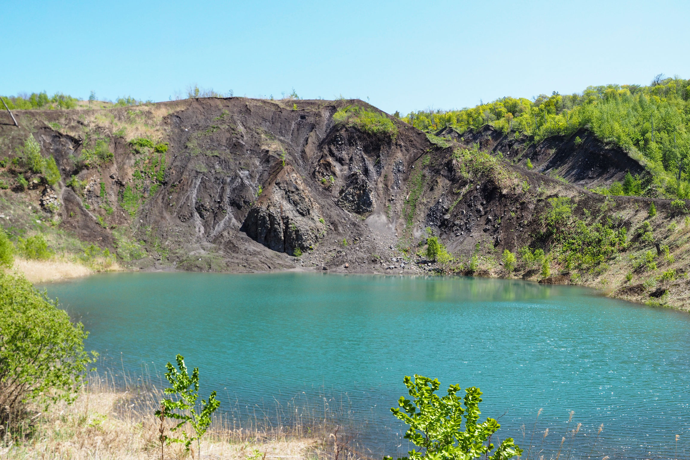
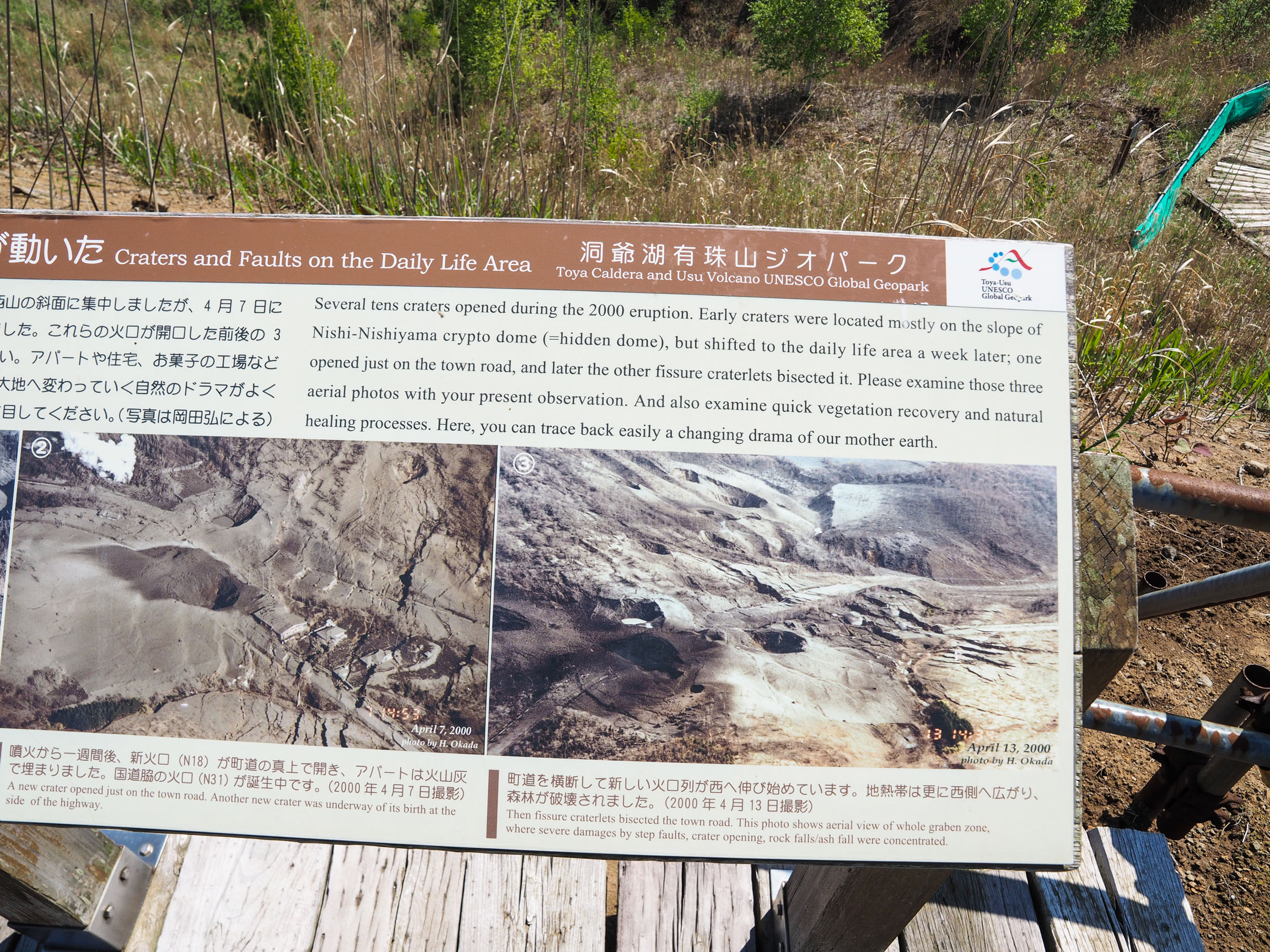
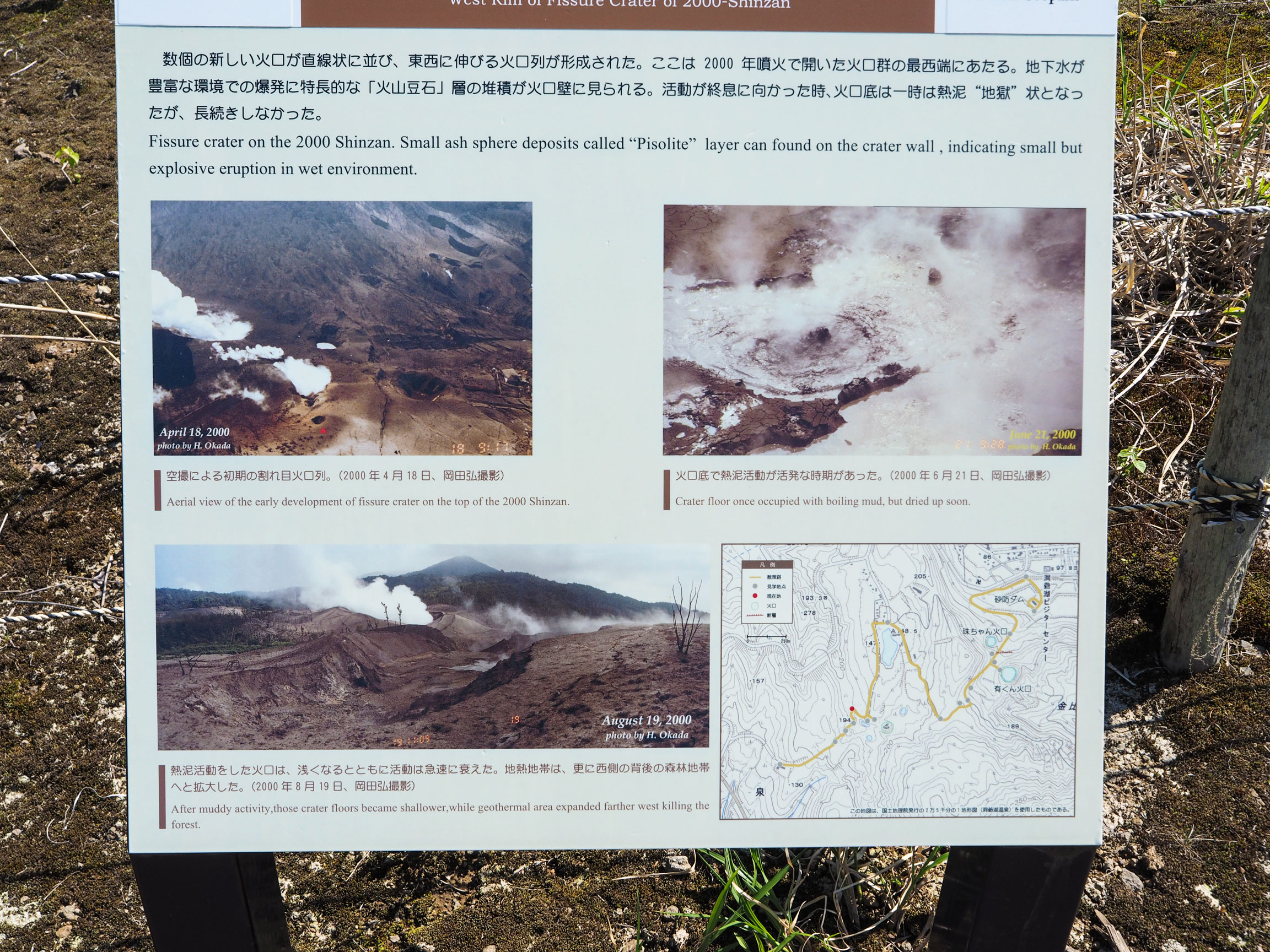
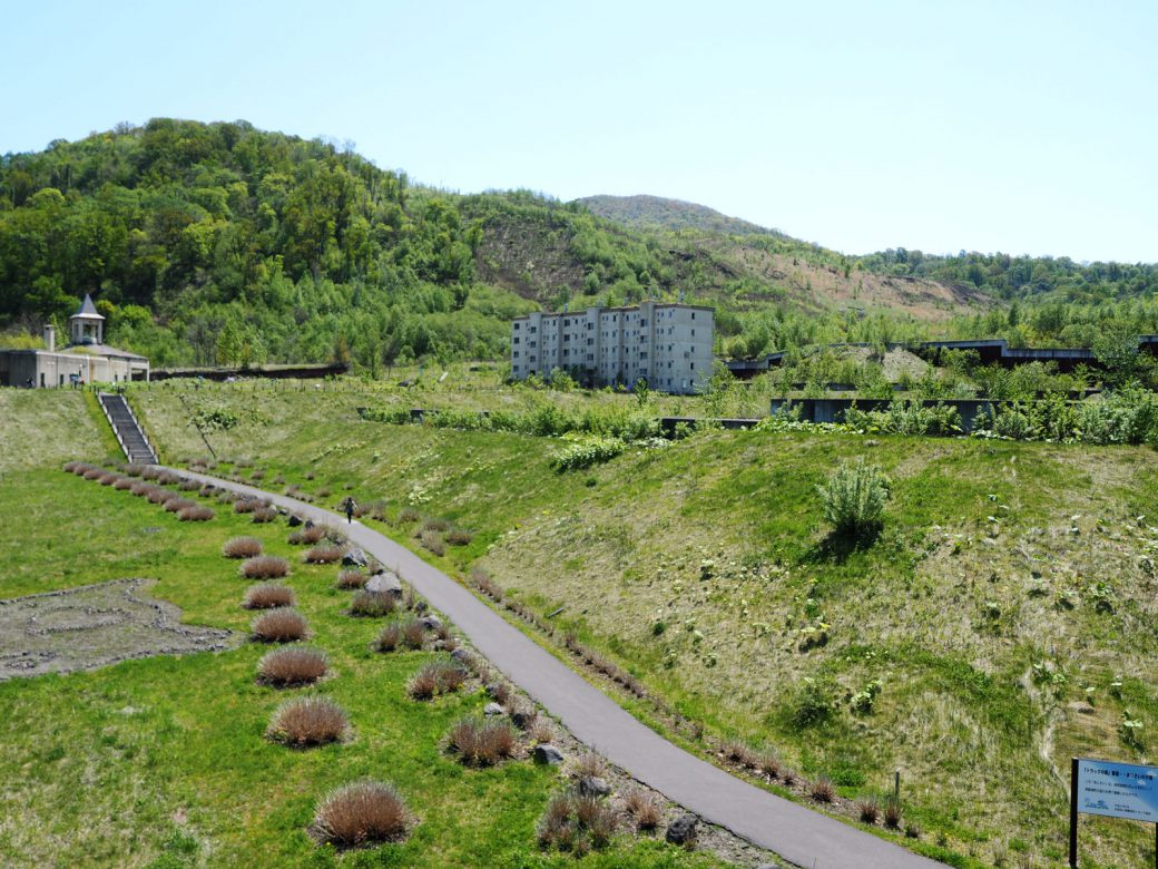
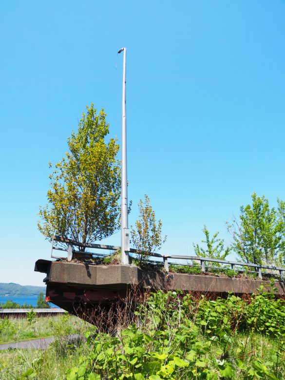
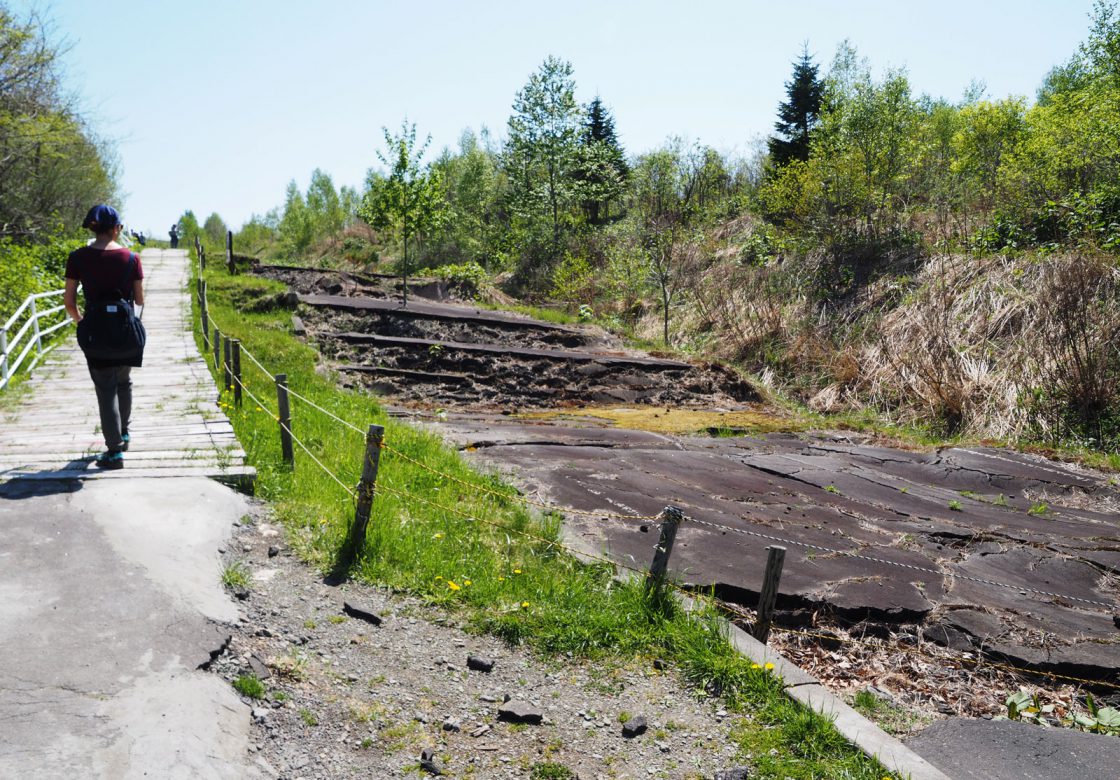
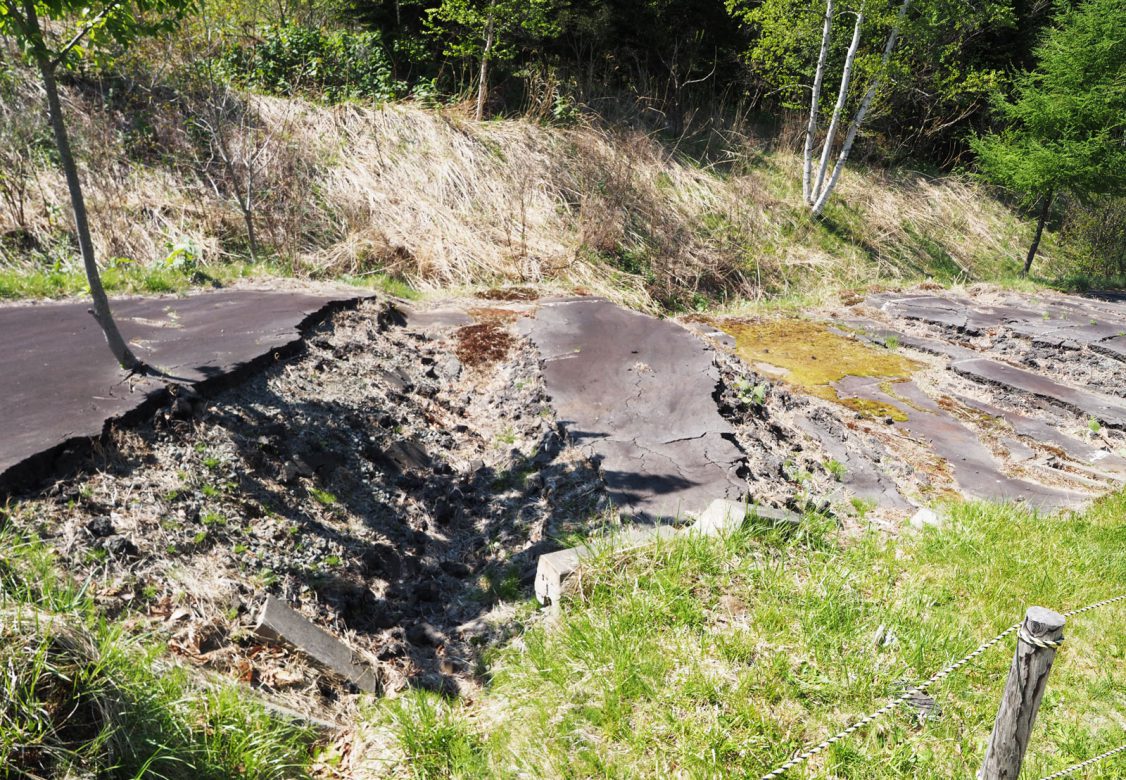
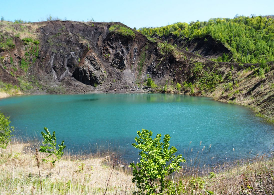
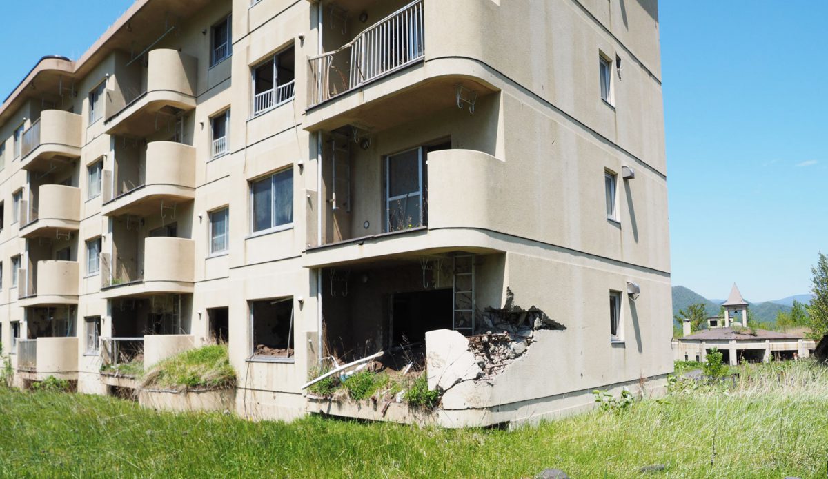
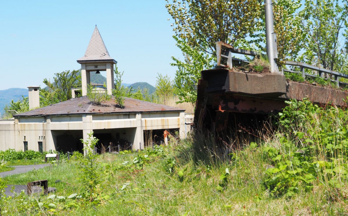
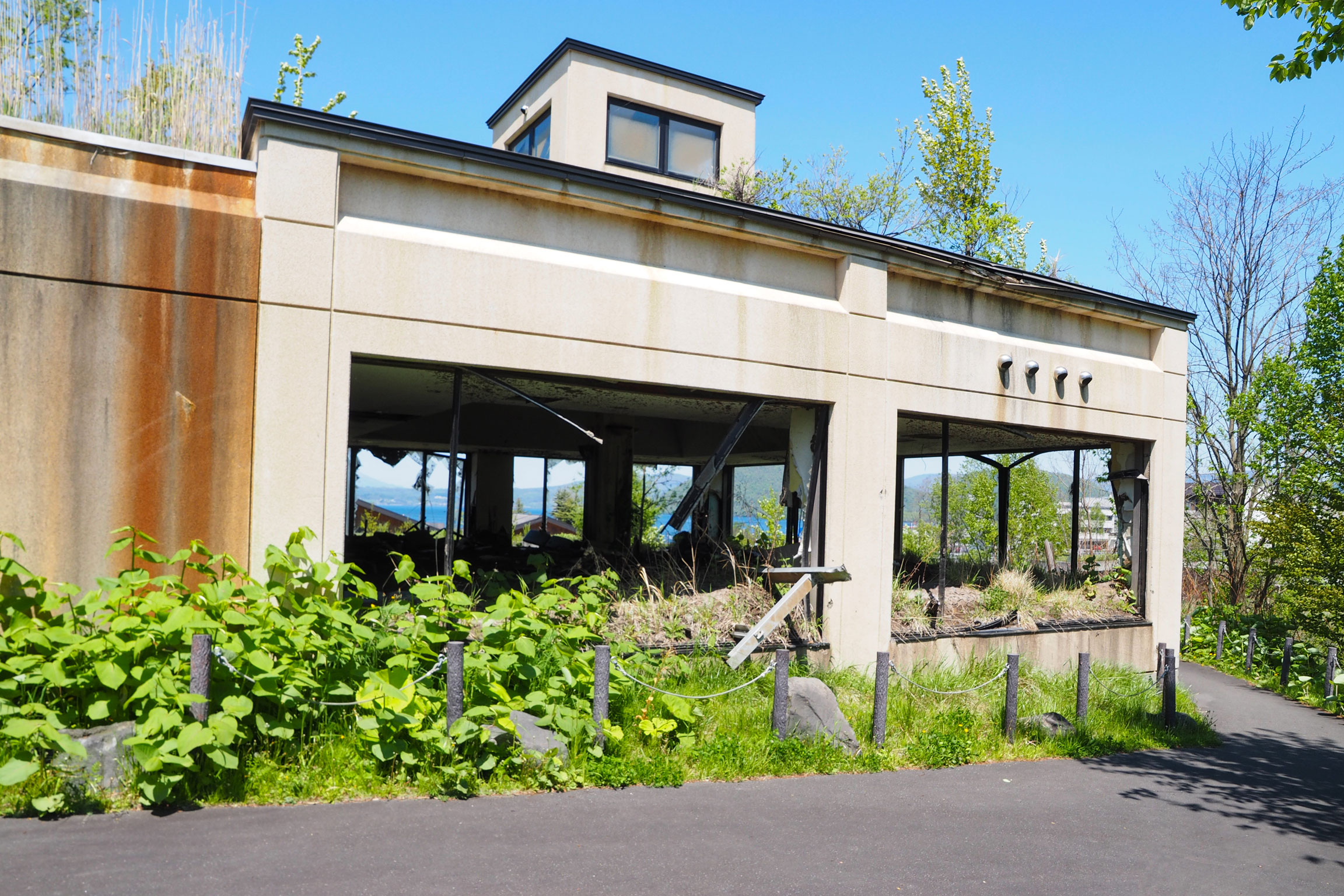
The walk follows the damage left by the 2000 eruption. A former public bathhouse and a public housing block, both buried under volcanic mud flow, are preserved exactly as they were left, inside a soil control facility along the route. Further on, the Nishiyama trail runs beside the remains of National Route 230: sections of road are cracked, lifted, and cut off by crater ponds, with traffic signs and infrastructure still standing but no longer serving any purpose.
Along the way you'll also cross a mini-graben, a narrow strip of ground that dropped down between two parallel cracks when the eruption pulled the surface apart, now a shallow trench running across the path.
Combined, the two trails run about 4.9 km, are clearly signposted, and have no real climbs, so they're easy to cover in a single afternoon, with time to spare for photos and stops along the boardwalks.

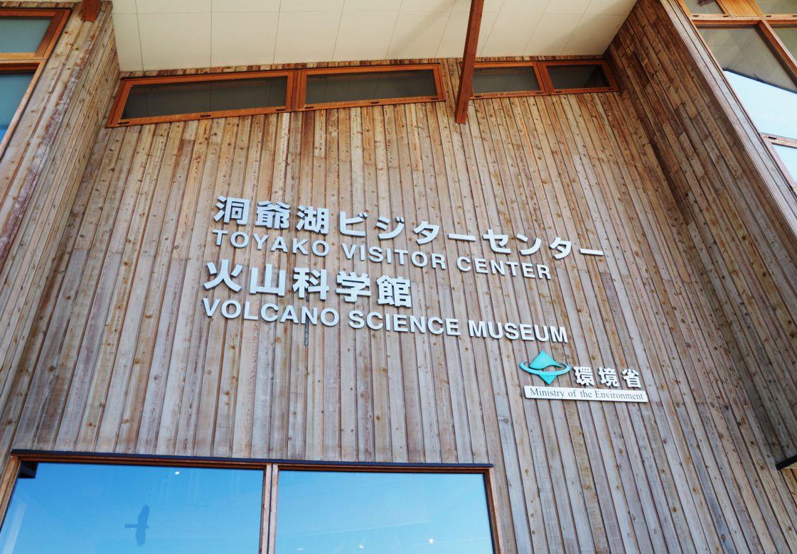
Toyako Visitor Center and Volcano Science Museum
Worth a stop before or after the crater walk. The free visitor center covers the wider Lake Toya environment, while the paid Volcano Science Museum focuses on Mount Usu's repeated eruptions, including the 2000 event behind the Nishiyama craters, using photographs, models, and damaged objects, with English explanations available. We visited after the trail, and the exhibits gave good context to the damage we'd just seen. Entrance fee - 600 yen.
More to do around lake Toya and Mount Usu
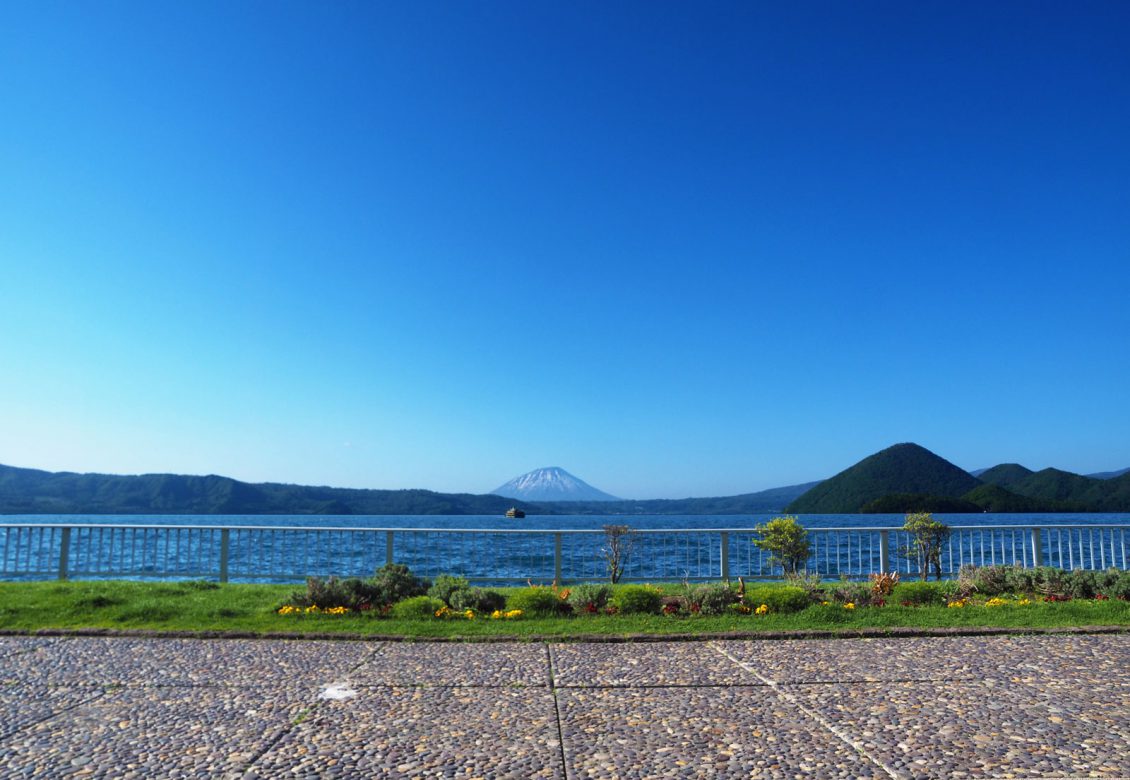
We paired the walk with a stroll along the lakeside promenade and a stay at The Lake View Toya Nonokaze Resort, which makes for a good one-day Lake Toya itinerary if you want nature, geology, and an onsen hotel without rushing.
Lake Toya easily supports a longer stay too: you can take a boat to Nakajima, climb one of the marked trails up Mount Usu to its southern rim (the ropeway can bring you back down), or simply ride the ropeway up for views over Mount Usu, Showa Shinzan, and the caldera lake.
Good to know
- getting there
Lake Toya is easy to reach on the main rail route between Hakodate and Sapporo. Get off at JR Toya Station, then take the local bus to Toyako Onsen; the ride takes about 20 minutes.
- Combine with
Pair the crater walk with the Toyako Visitor Center, the lakeside promenade in Toyako Onsen, and an overnight stay at The Lake View Toya Nonokaze Resort.
- Location
-
Toya Lake, Hokkaido Open in maps (external link)
- Details
-
Visited Last checked