Hiking around Mount Aso 阿蘇山
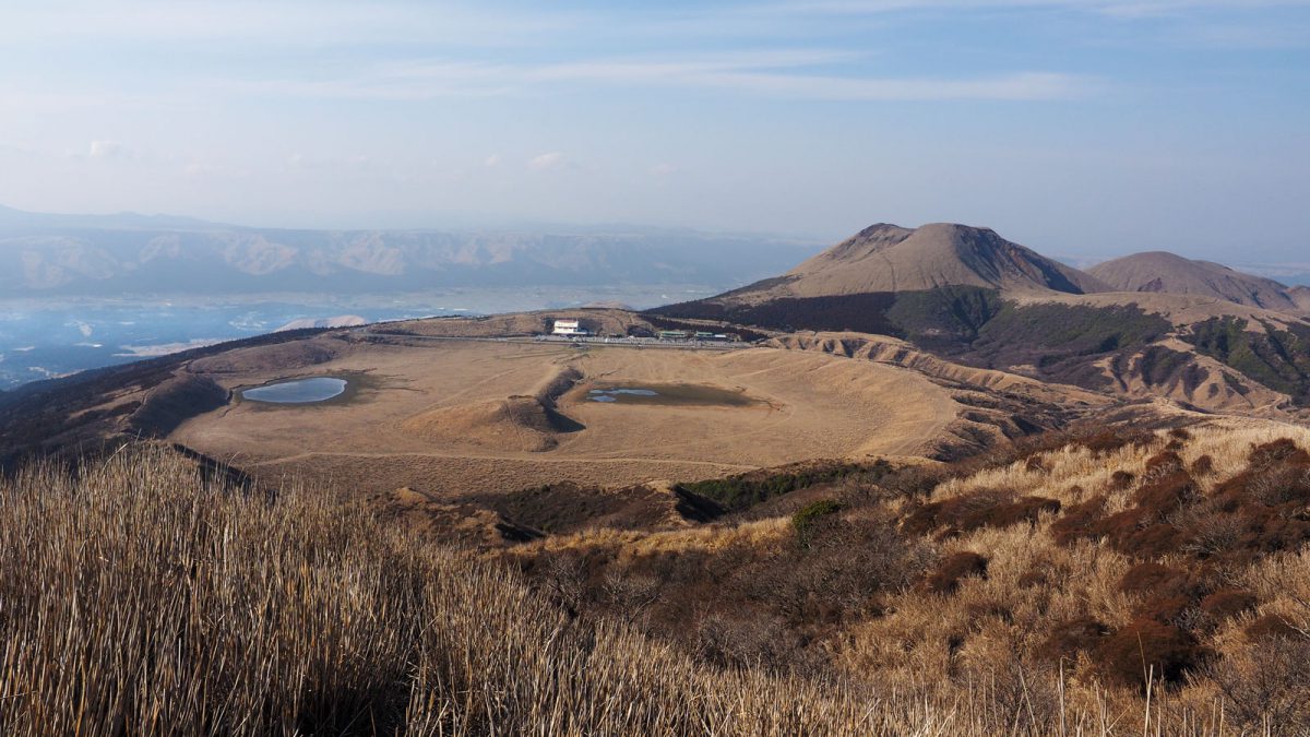
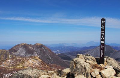
Mount Aso is not just one mountain, rather a range of volcanoes sitting in a huge caldera. It’s actually one of the world’s largest, spanning an area of 350 km² with a circumference of 100 km. There are 5 main peaks: the Nakadake 中岳(1,506 m), Eboshidake 烏帽子岳 (1,337 m), Kishimadake 杵島岳 (1,321 m), Nekodake 根子岳 (1,433 m) and Takadake 高岳 (1,592 m). The open views are worthwhile from any side you may climb. You can spot the town of Aso in the distance, sitting in the northern part of the caldera with roads and railways looping around these peaks.
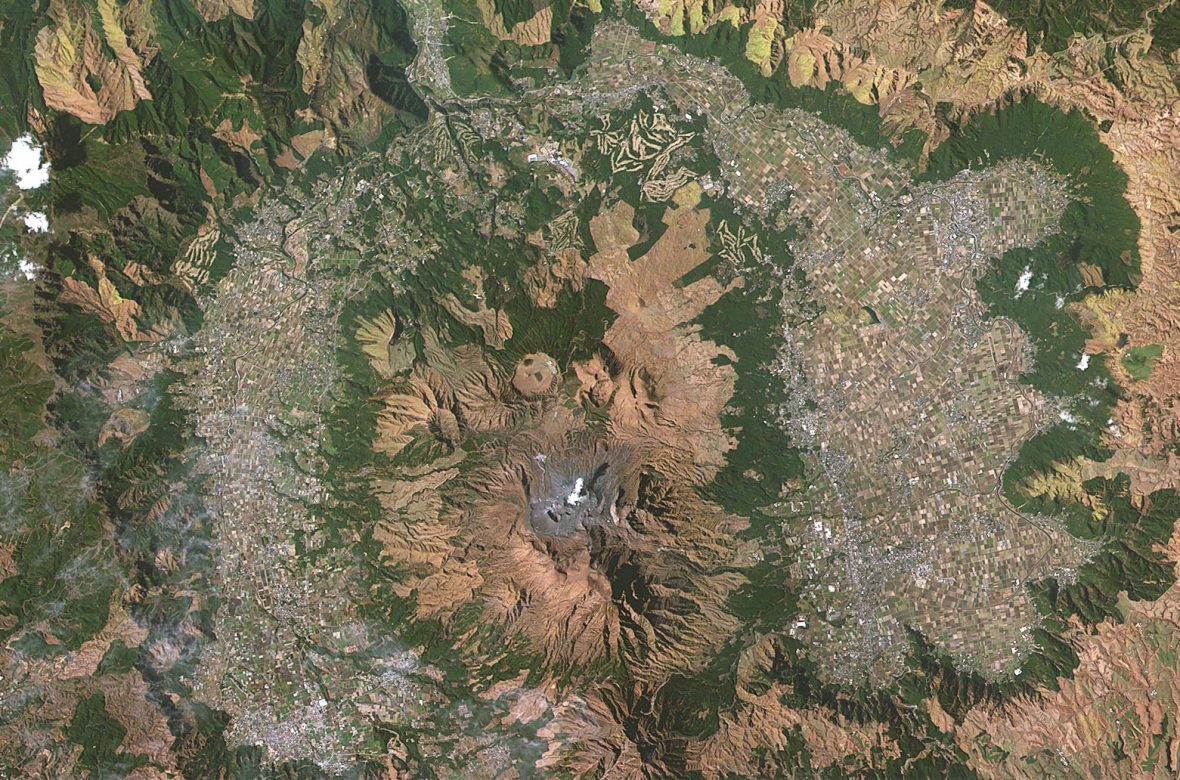
Satellite view of the Aso caldera, © wikipedia
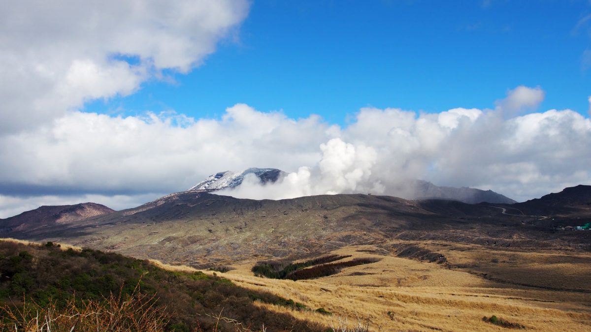
Nakadake crater
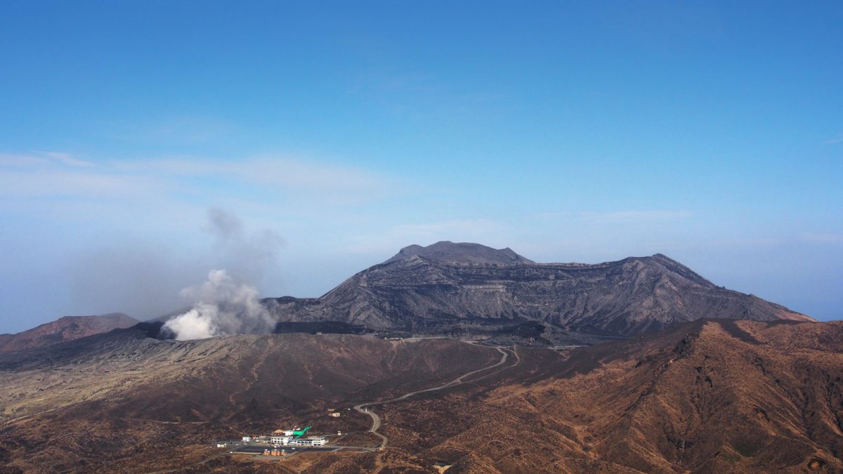
Mt. Nakadake has been very active since prehistoric times; today it’s one of the few active volcanoes in Japan – last erupted on April 16 2019. At the time of our visit the crater was not accessible. What impressed us even from a distance were the furious, strong fumes continuously blasting from the crater combined with a thunderous roar, as if it was on the verge of a new eruption.
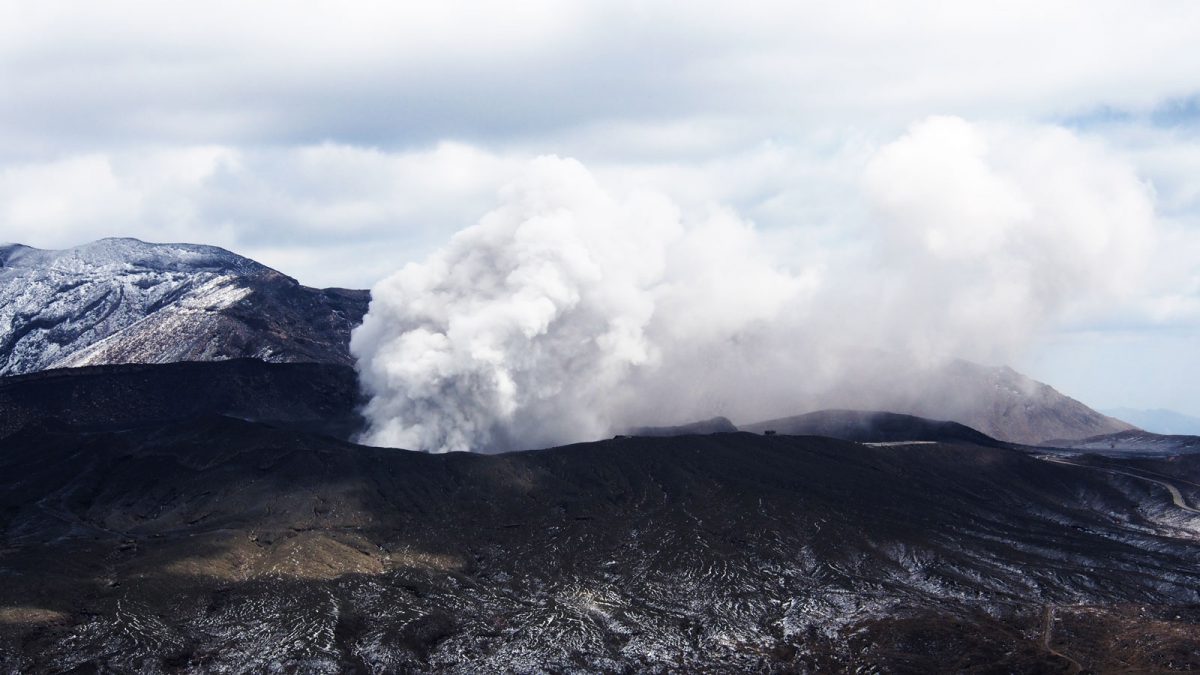
Nakadake crater, Aso © Rekall
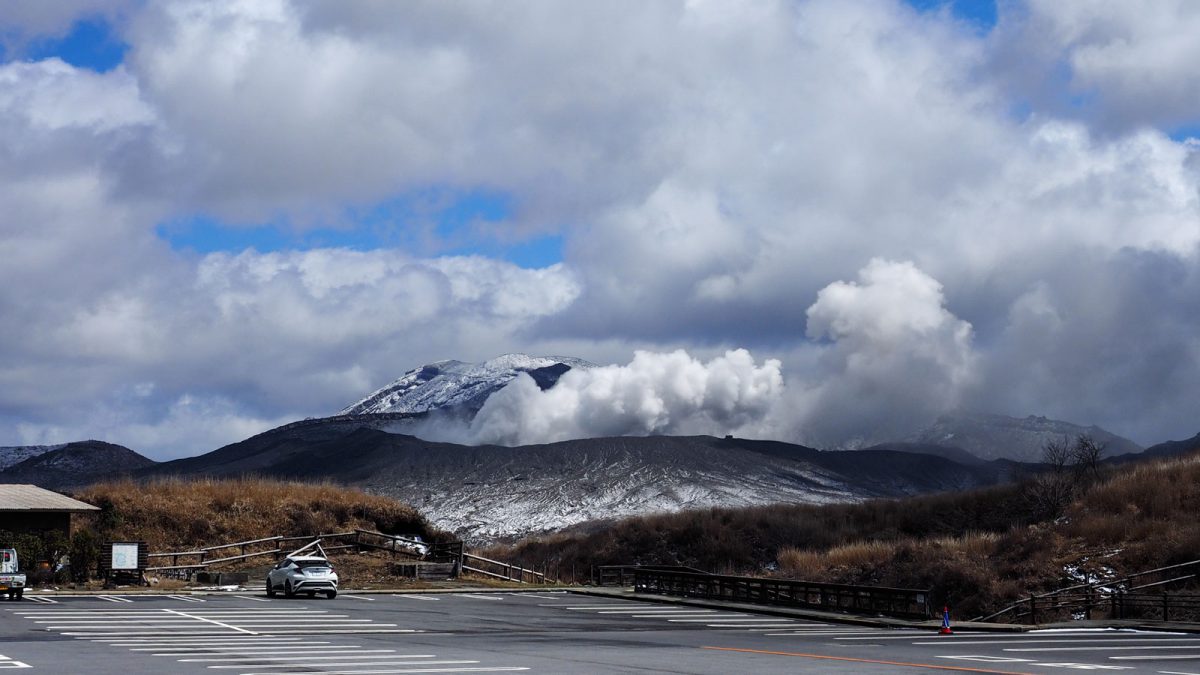
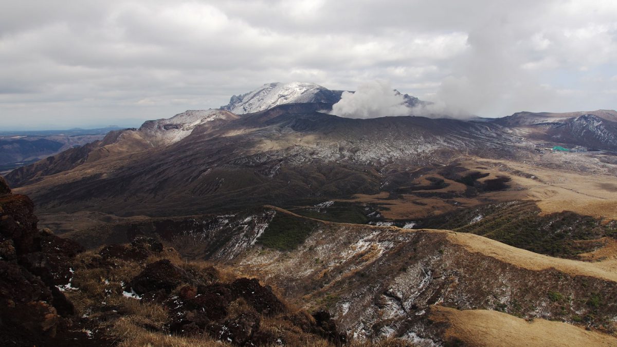
View of the Nakadake crater from one of the parking lots, © Rekall
Getting to Aso
The hiking area of the central crater group can be reached by car or bus. You start at an altitude of 1,100 m. The hiking routes are situated around the 4 main peaks but the two of them, the active volcano Nakadake and the mount behind it Takadake, are often closed due to dangerous gasses and high volcanic activity. The starting trail for the fifth peak, Nekodake, is located further away with a different route leading to its ascent.
Park your car at the main parking lot (500 yen per day), it’s the best spot to begin your hikes. There are shops, toilets and the adjacent Volcano Museum (which was closed during our visit due to corona).
Hiking the Eboshidake and Kishimadake
Important: Before starting the hikes, go first to the other parking lot, the one of the Nakadake crater. There is an info shop center where you can get a hiking map of the area in English, very useful. It will help you orientate and see the approx. times and lengths of the different trails.
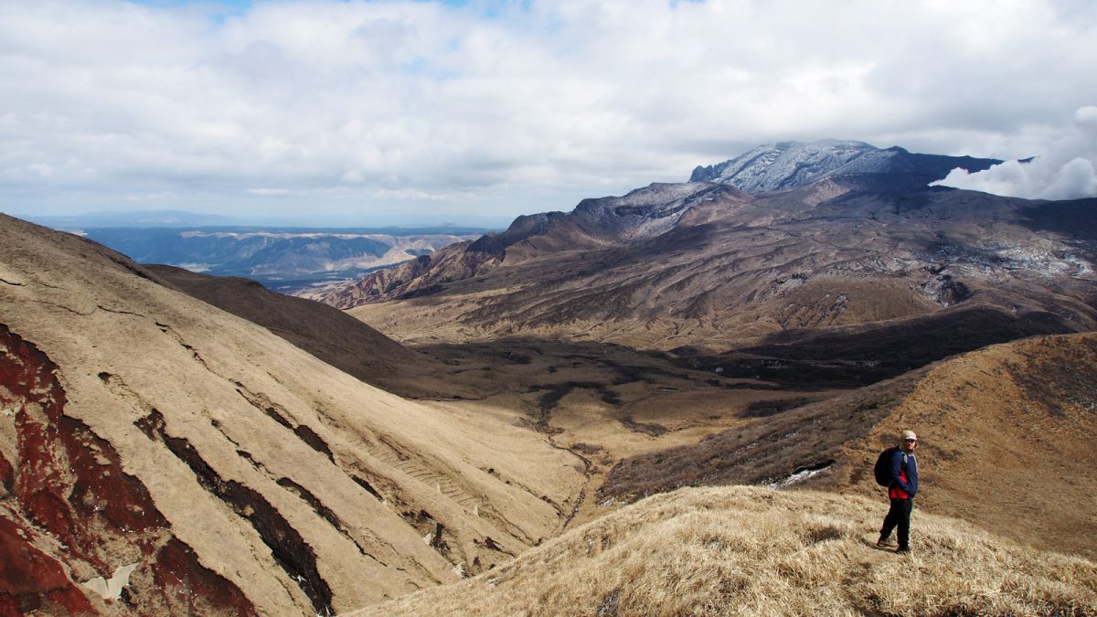
Both walks were not too demanding, taking an hour or 2 for the loop trail to finish. Kusasenri-ga-hama 草千里ケ浜 and Eboshidake were the easiest and most relaxing walks of the calderas. The trail is a nice loop going from one to the other side of the mountain with beautiful views of Kusasenri and the whole caldera.
Mt. Kishimadake was slightly more demanding but nothing too serious. The paths are clear and well marked. Hiking shoes are recommended since you walk on loose volcanic rock which can be slippery sometimes.
Views from Kishimadake, © Rekall
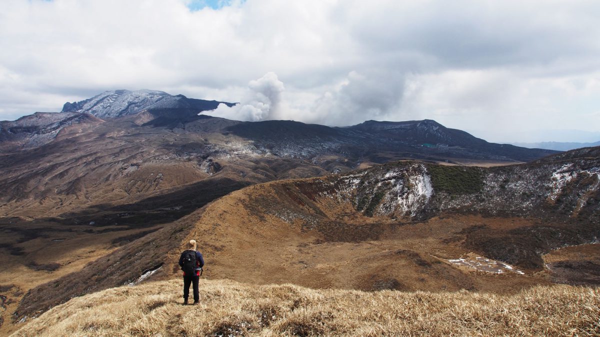
Nakadake crater seen from Kishimadake, © Rekall
Nakadake crater seen from Kishimadake, © Rekall
Views from Kishimadake, © Rekall
View from Eboshidake, © Rekall
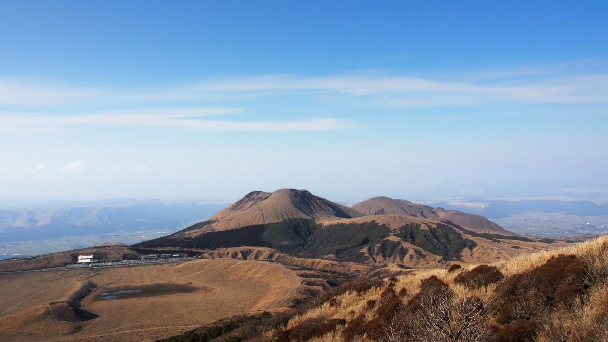
View from Eboshidake looking at Kishimadake, © Rekall
Practical info
Mount Aso belongs to the Aso-Kuju National Park, located in the center of Kyushu, encompassing Mount Aso and the Kuju Mountains. As of september 2020 Nakadake and Takadake can be hiked since the no-entry zone around the volcano has been lifted.
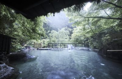
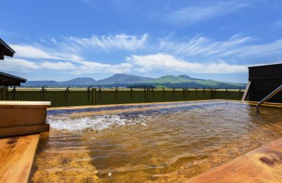
In the evening we stayed at the very recommendable Aso Plaza Hotel in the town of Aso. We spent a total of 4 days around Aso and the Kuju mountains and rented a car to get around easily.
- Google maps location
- Volcanic activity mount Aso situation
- Extra info about Aso from japan-guide.com
We last visited in March 2020.