Mt. Karakunidake hike in Kirishima
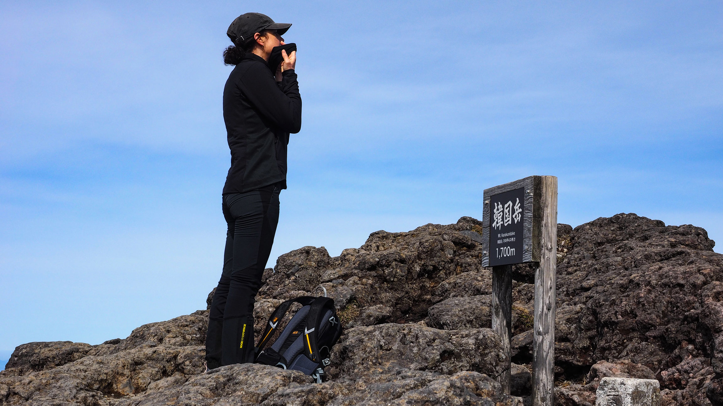
韓国岳
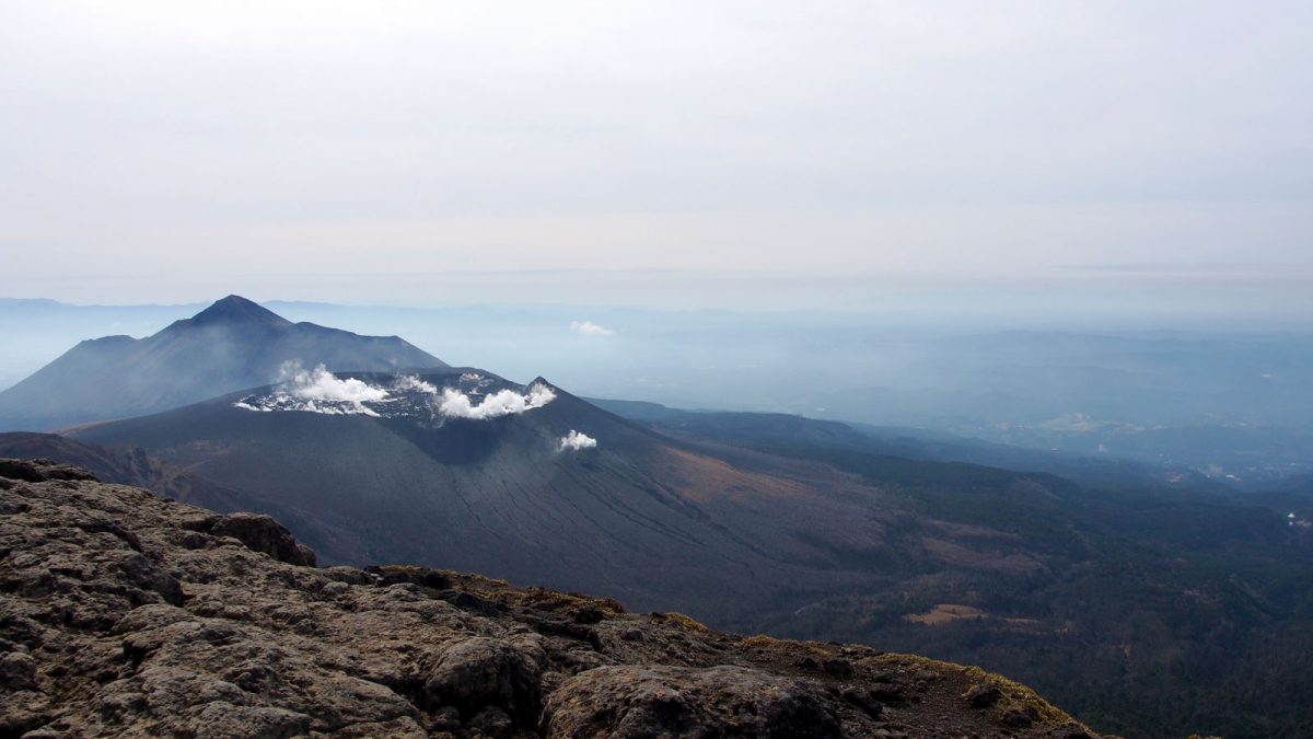
The tallest peak in the Kirishima range, with the best view of Shinmoedake's active crater.
The Kirishima Geopark
The Kirishima Mountains (霧島山) straddle Miyazaki and Kagoshima Prefectures in southern Kyushu. The range is made up of more than 20 volcanoes spread across 600 km², shaped by eruptive activity going back hundreds of thousands of years. Its name is thought to come from the way the peaks appear to float like islands in the mist — 霧 (kiri) meaning fog, 島 (shima) meaning island. The area is designated a Geopark — a recognition of outstanding geological heritage and the cultures that developed alongside it. Kirishima received that certification in 2010.
We spent two days hiking in the Geopark, completing one route each day. We started with the Takachihonomine hike, followed by Karakunidake on the second day. Our base was Maruo Onsen, from where we took the morning bus to the trailhead and returned in the afternoon — a rhythm that worked well and left us with long dinners and good onsen to look forward to.
Karakunidake hike
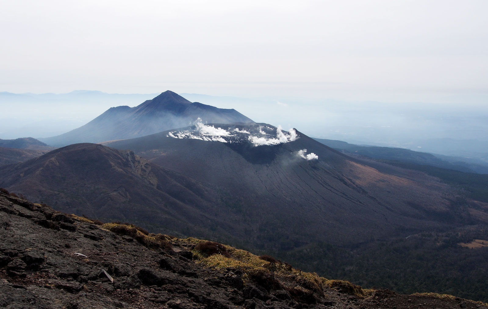
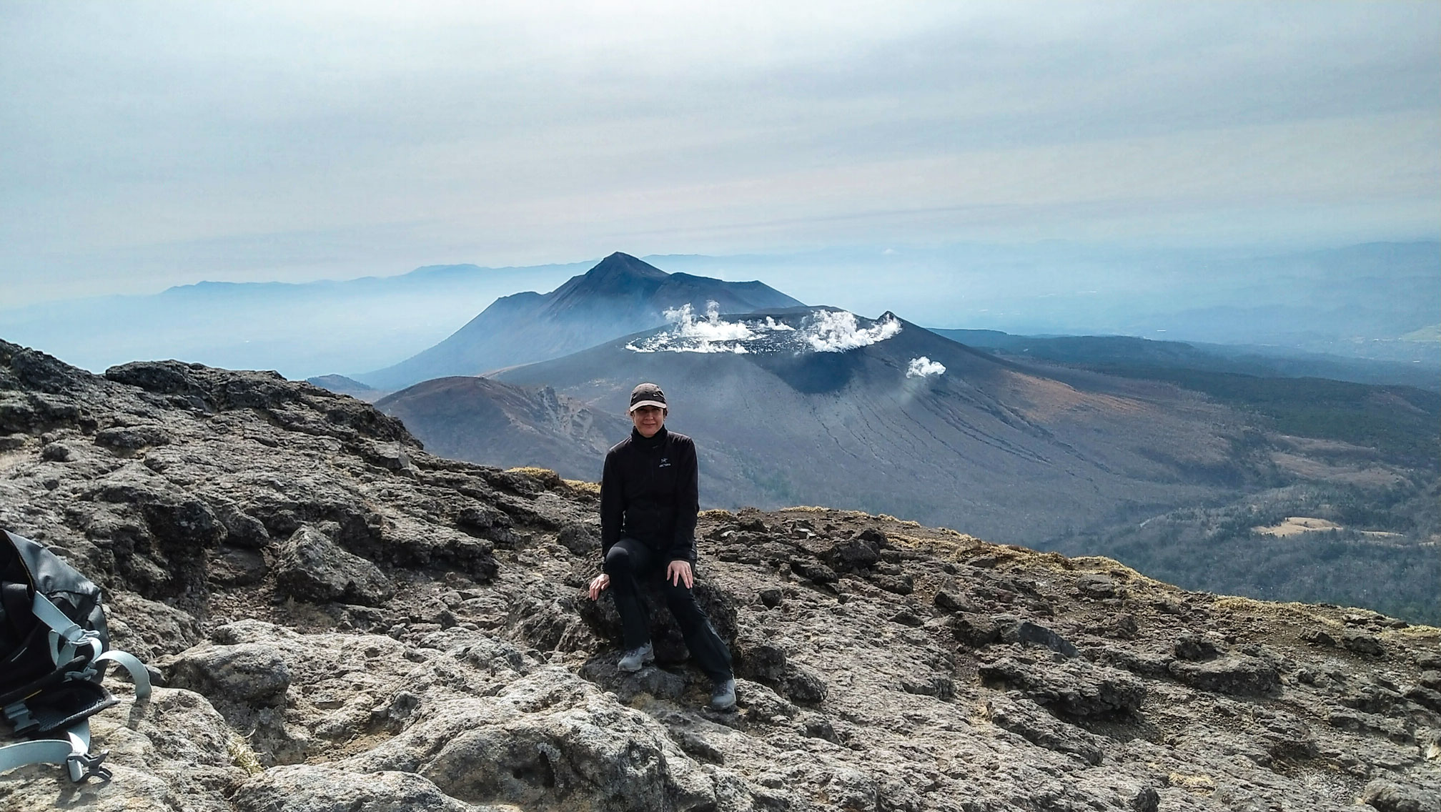
Karakunidake 韓国岳 (1,700 m) is the highest peak in the Kirishima Mountains. Its name means “Korea Peak,” as the mountain was once believed to be tall enough to see the Korean Peninsula from its summit. We didn’t spot Korea, but Sakurajima volcano was clearly visible.
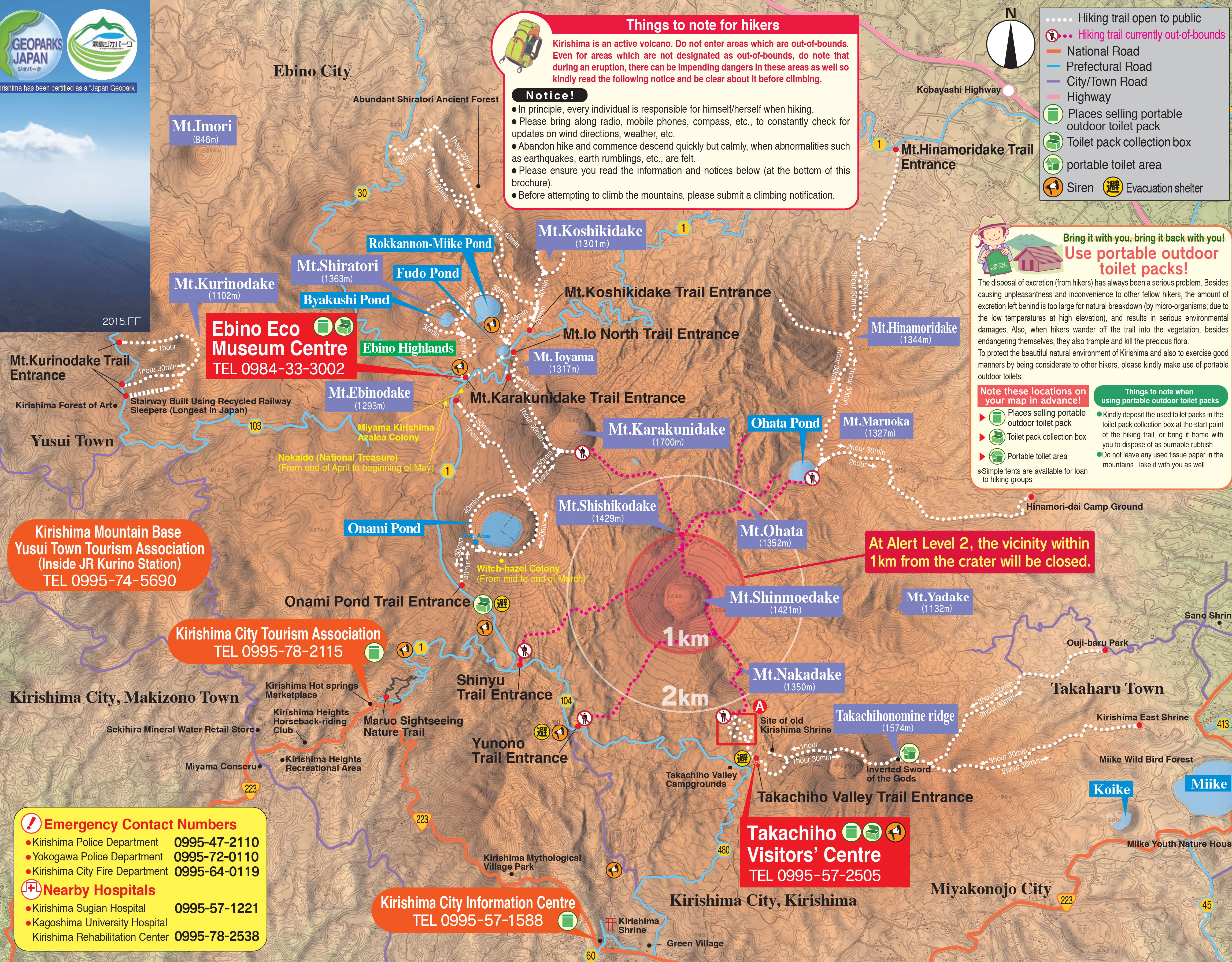
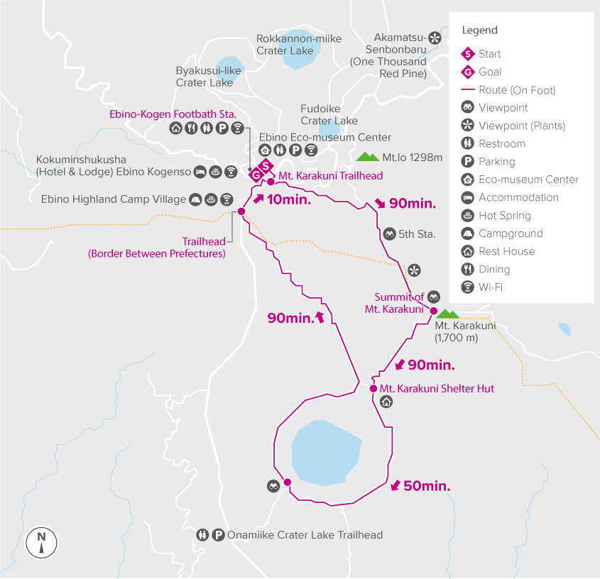
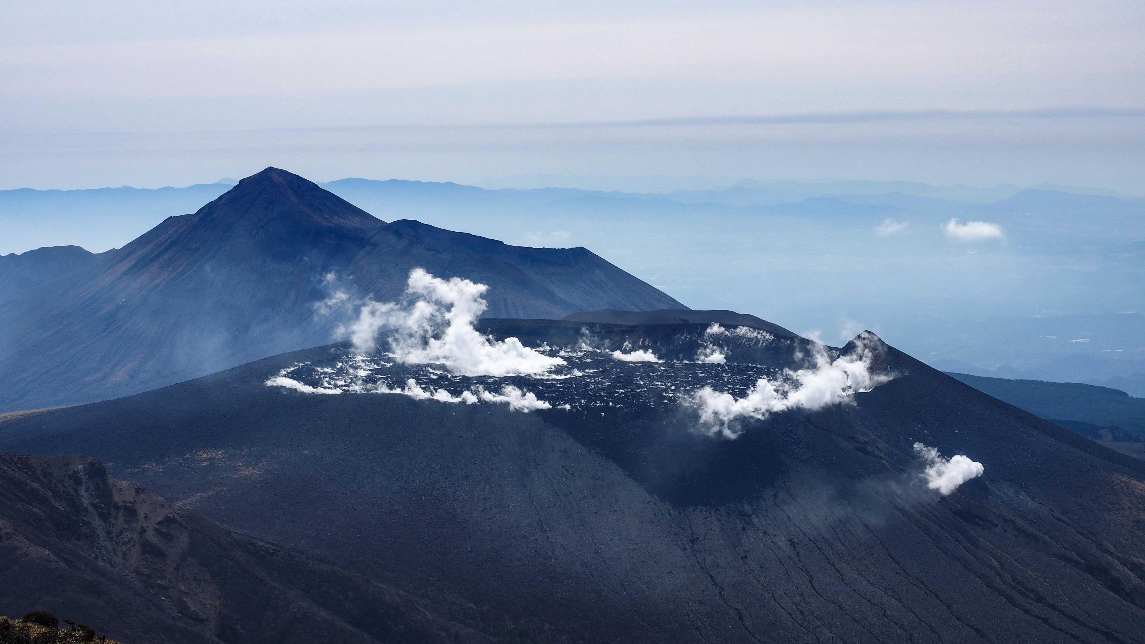
The trail starts from the Ebino Plateau bus stop, where there is a restaurant and a small shop. Trail total length is 9.7 km. The climb to the summit takes around 1,5 hours. From the top you get the clearest view anywhere in the range of Shinmoedake (新燃岳), the still-active neighbouring volcano that has been a no-entry zone for several years. Seeing its fumes rising steadily from below gives a vivid sense of the geological forces still at work across the range.
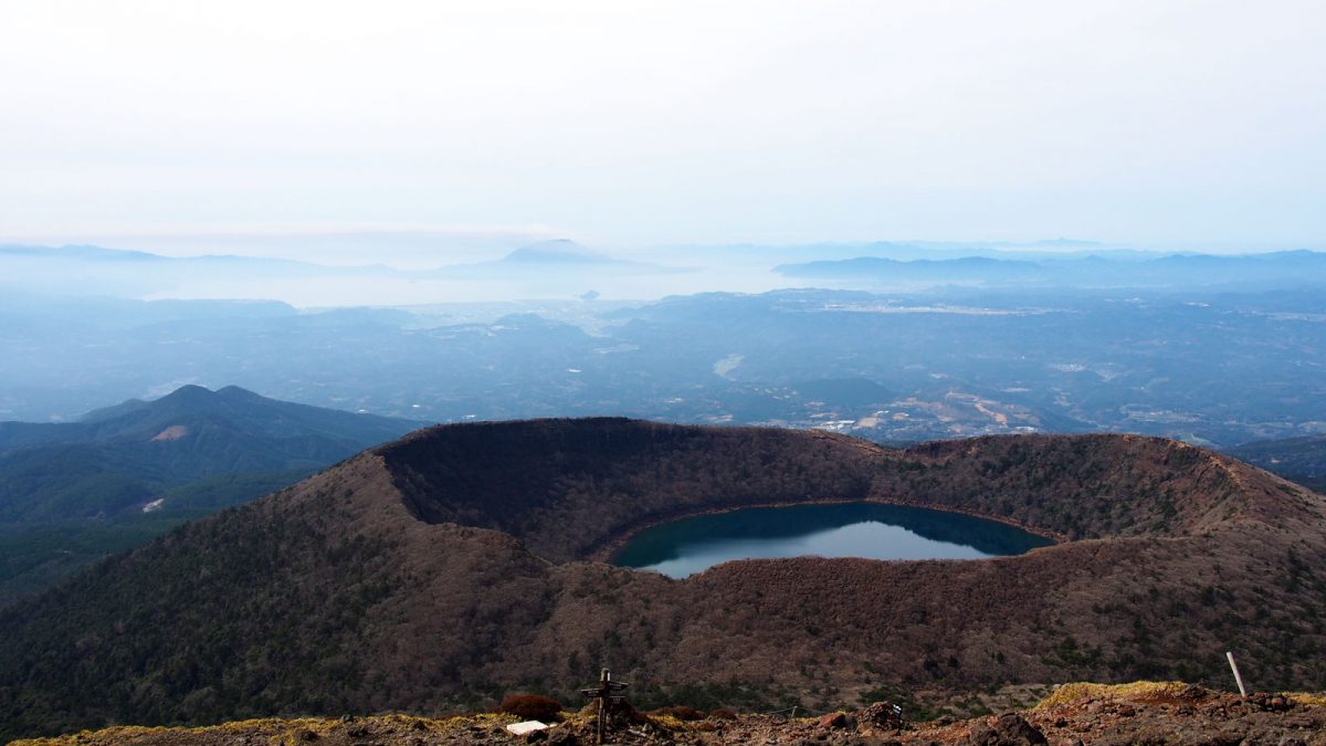
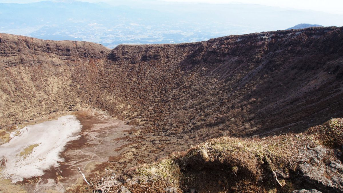
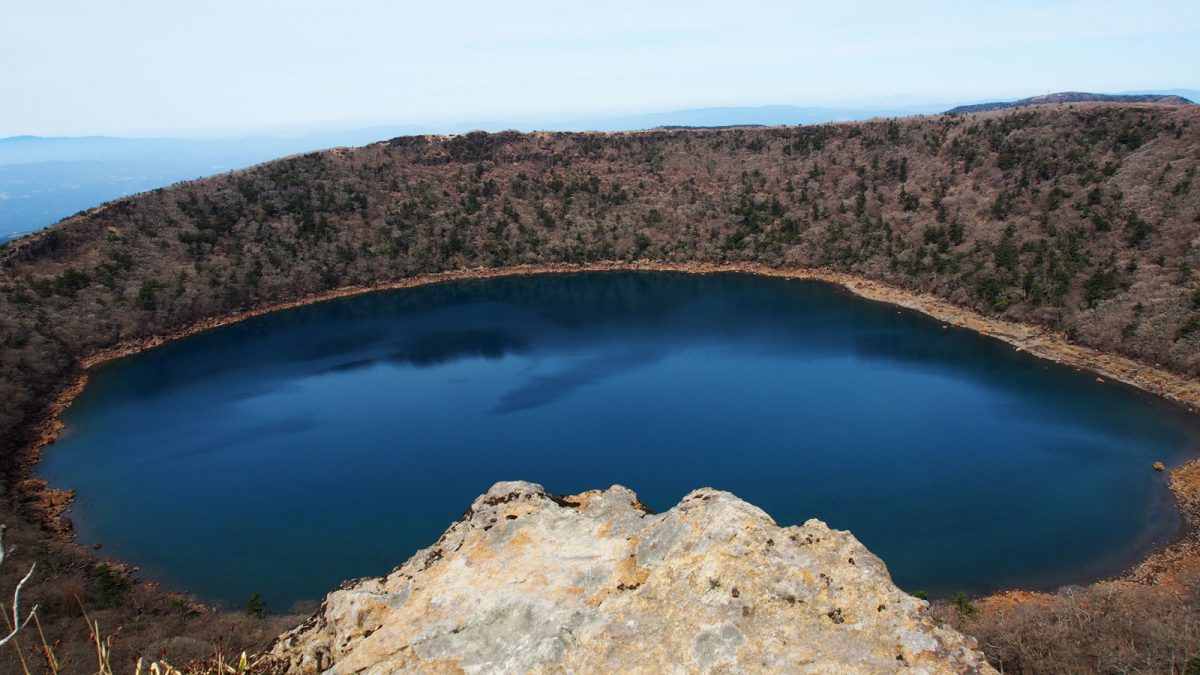
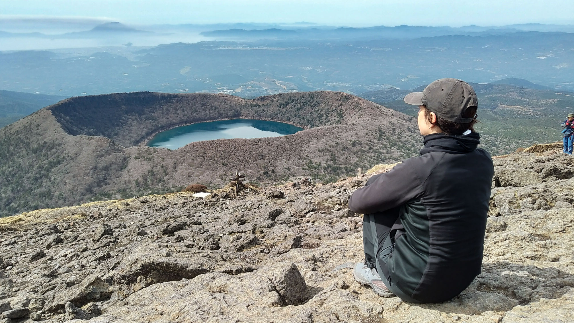
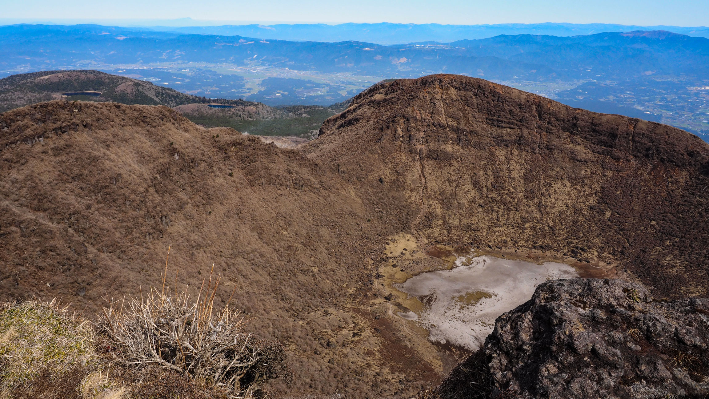
After descending from the summit, the trail connects to the Onamiike pond circuit — a loop around a perfectly conical crater lake that brings you back to the bus stop. This second half of the day felt like a different world from the bare summit: woods, greenery, still water, and the steep symmetrical walls of the crater reflected in the lake. More varied than the exposed ridge of the Takachihonomine hike, and a satisfying contrast to end on.
The full loop, depending on route, takes around 4 to 6 hours.
Good to know
- Access
Only three buses per day serve Ebino Plateau. We took the morning bus from Kirishima Onsen and planned the return around the second last bus of the day. A car gives you much more flexibility, but the bus worked fine for us. The bus timetable is printed on the Kirishima trekking map, available in English at the tourist office in Kirishima Onsen.
- Food
There is a restaurant and a small shop at the Ebino Plateau bus stop. For a longer day out, bring lunch from a supermarket or pick something up in Kirishima Onsen before heading out.
- Stay
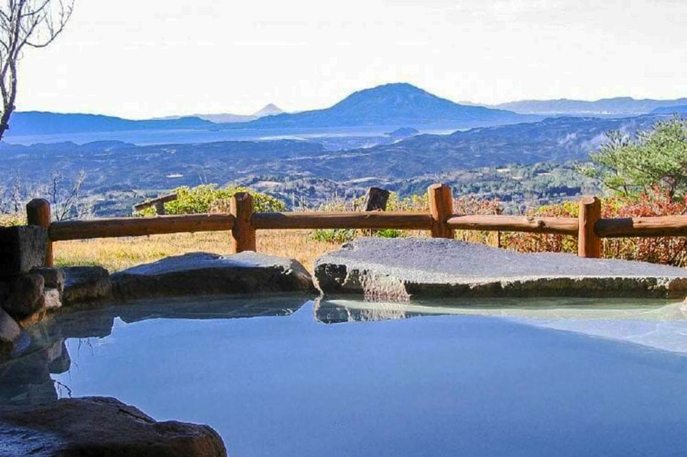
We stayed in the Ryokojin Sanso in Kirishima Onsen, a natural base for both days of hiking
- Trekking map
Get a paper map of the Kirishima mountains in Kirishima Onsen Visitor Center or check the Kirishima trekking map in PDF (external link)
- GPX track
-
Download the GPX track of Mt. Karakunidake hike in Kirishima, for your maps app or GPS watch.
- Location
-
Kirishima Onsen Open in maps (external link)
- Details
-
Visited Last checked