Takachihonomine hike in Kirishima
高千穂峰
A ridge walk across volcanic terrain steeped in Japanese creation myth.

The Kirishima Mountains Geopark
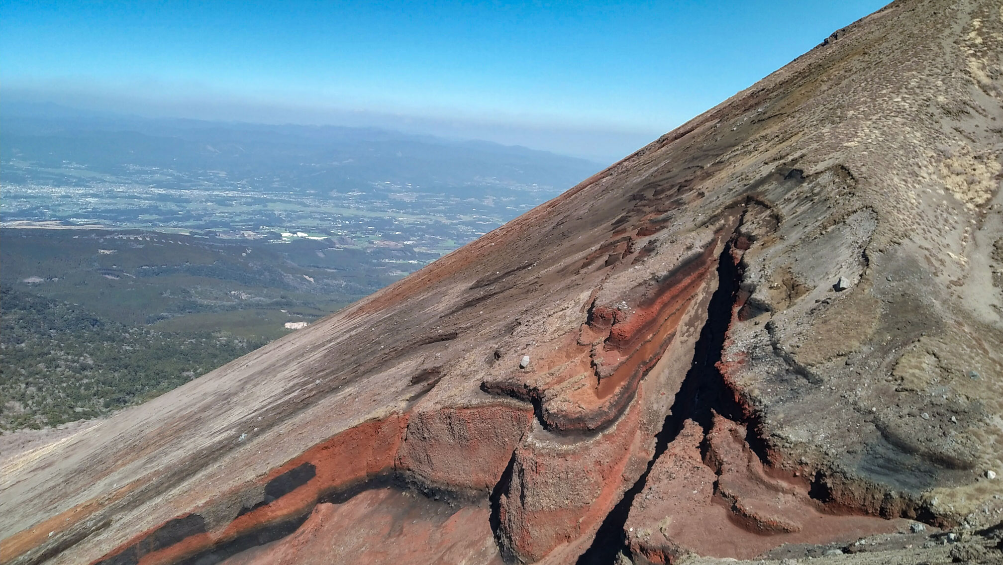
The Kirishima Mountains (霧島山) straddle Miyazaki and Kagoshima Prefectures in southern Kyushu. The range is made up of more than 20 volcanoes spread across 600 km², each at a different stage of activity, and together they form one of the most geologically varied hiking areas in Japan. The surfaces are unlike anything else: black, red and yellow rock formations, moon-like in places, shaped by hundreds of thousands of years of eruptions. The area is designated a Geopark — a recognition of outstanding geological heritage and the cultures that developed alongside it. Kirishima received that certification in 2010.
We spent two days in the Geopark and did one hike each day. We started with the Takachihonomine hike, followed by Karakunidake on the second day. Our base was Ryokojin Sanso in Maruo Onsen, from where we took the morning bus to the trailhead and returned in the afternoon — a rhythm that worked well and left us with long dinners and good onsen to look forward to.
Hike along the Takachihonomine ridge
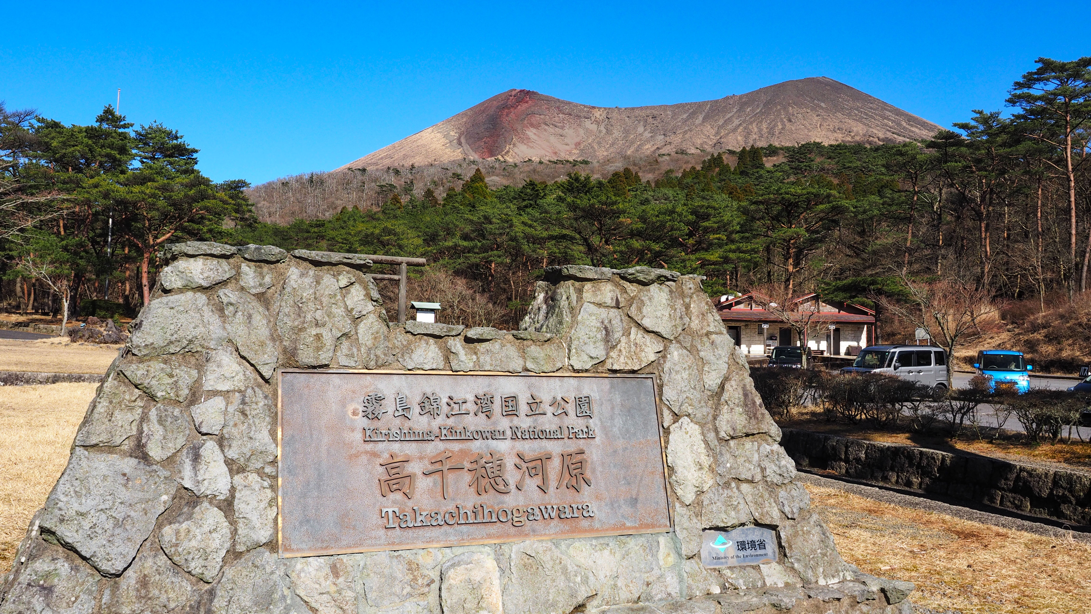
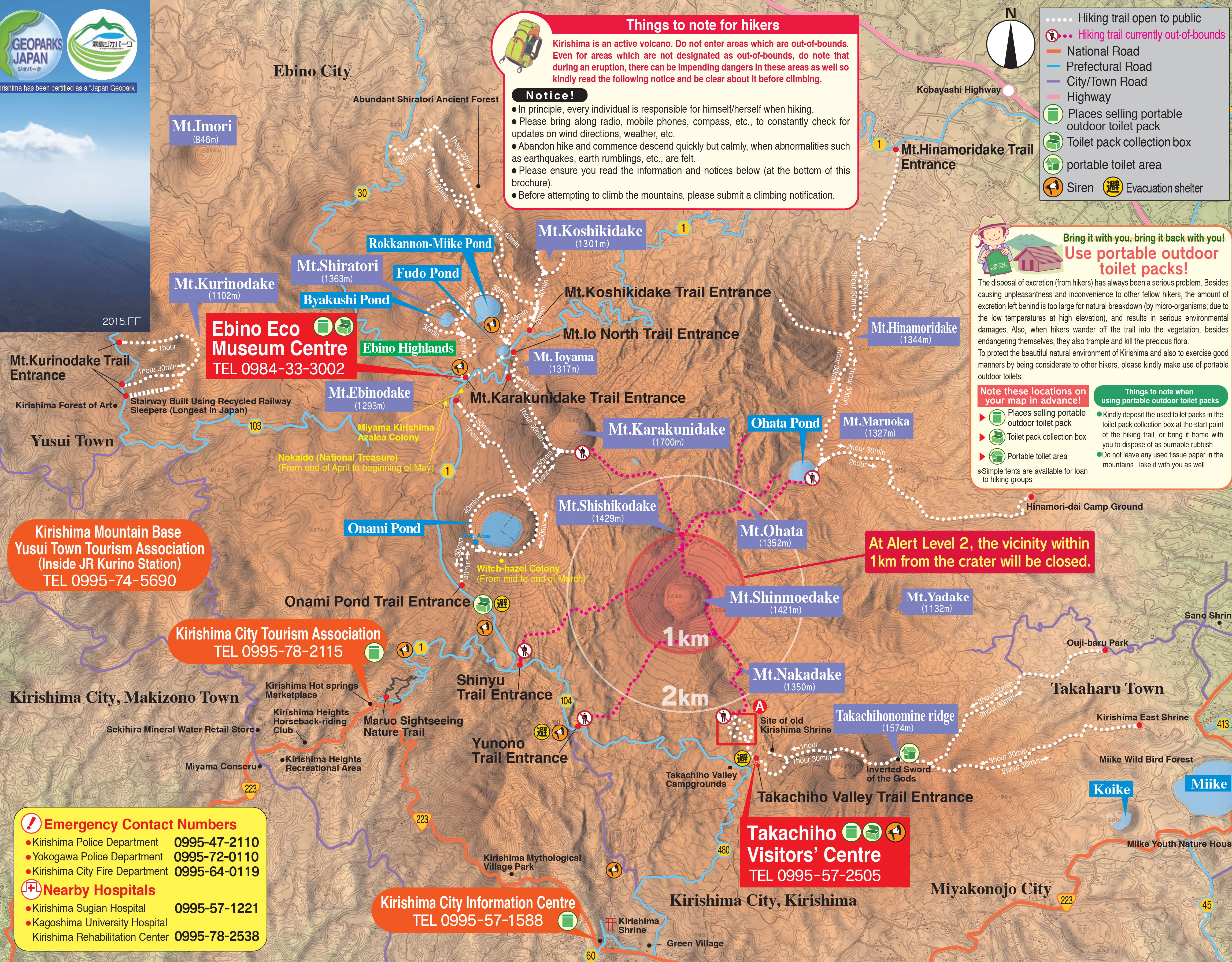
Takachihonomine (高千穂峰, 1574m) is the second highest peak in the Geopark and the most mythologically significant. The trail starts from the Takachiho-gawara Visitor Center, with payed parking (fee 500yen) where there are drink vending machines and toilets — bring your own food, as there is nothing else on the route.
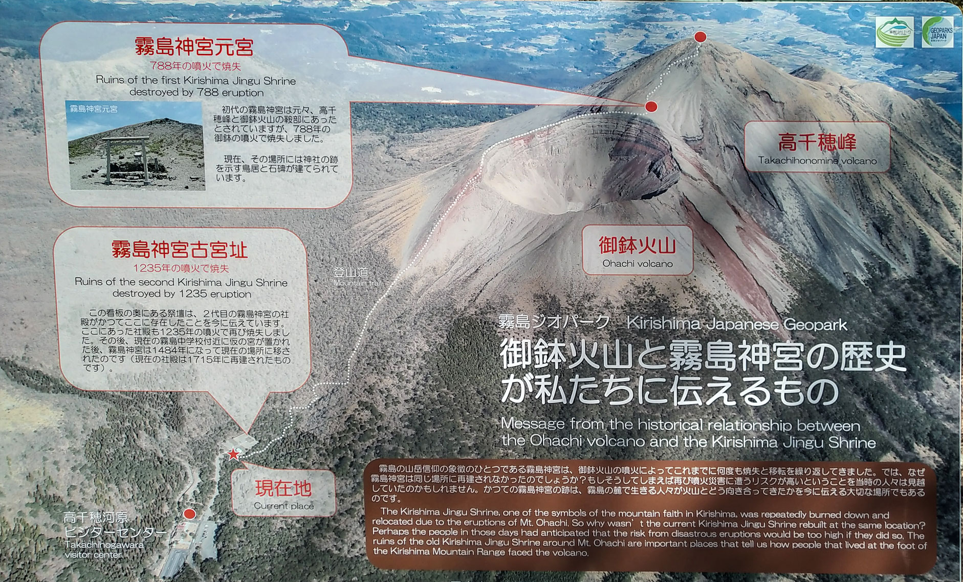
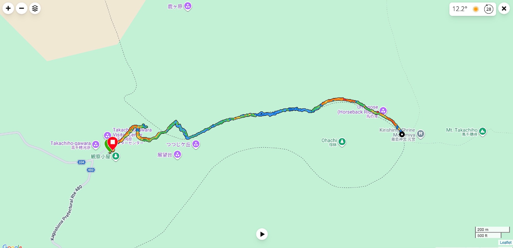
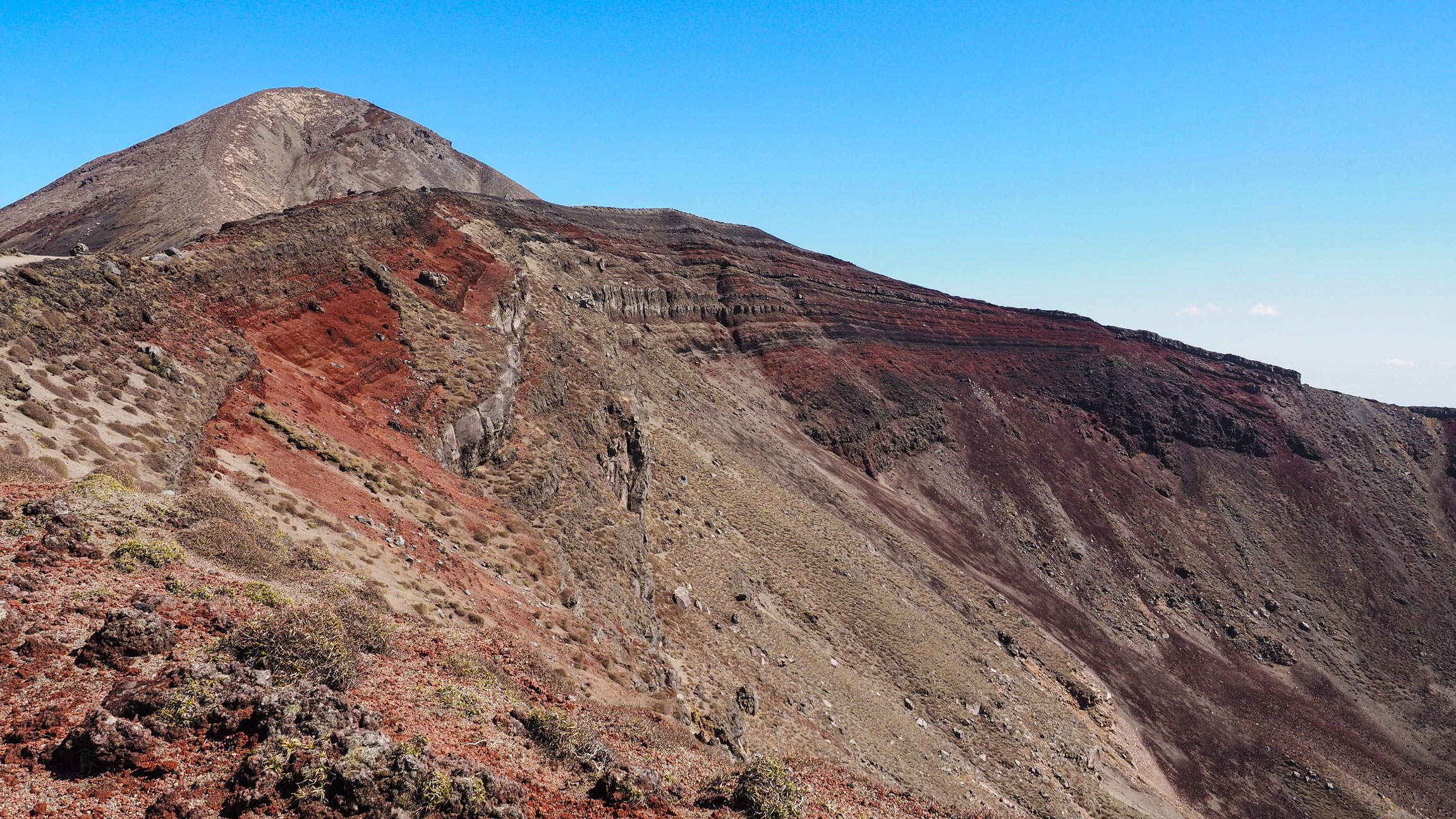
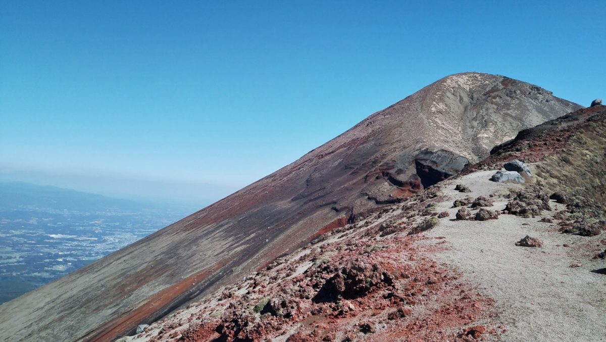
The ascent begins steeply on loose gravel and pumice, the kind of unstable surface that makes every step feel like two. It is tiring, but short — around 30 minutes to gain the ridge. Once up, the effort dissolves. The walk along the Ohachi volcano crater rim is one of the most dramatic ridge walks we have done: open in every direction, the crater dropping away on one side and the broader Kirishima range stretching out on the other. From there the trail connects to the Takachiho ridge itself.
The total walk is 2.5 to 3 hours. We did not make it to the summit — the last bus dictated our turnaround — but it remains one of the most impressive hikes we have done in Japan. And we will be back!


Legend
Takachiho is no ordinary peak. According to Japanese creation mythology, this is where Ninigi-no-Mikoto, grandson of the sun goddess Amaterasu, descended from the heavens to earth — the event known as Tenson kōrin (天孫降臨). He is said to have thrust his spear into the summit to mark the spot, and a large bronze spear still stands there today. The trailhead clearing at Takachiho-gawara is considered the sacred site of this descent and was the original location of Kirishima Jingū shrine before repeated eruptions forced it to be relocated.
The peak also has a more recent connection: the samurai Sakamoto Ryoma and his wife Ryo Narasaki climbed Takachihonomine together in the 1860s, on what is considered Japan's first honeymoon.
Good to know
- Getting there
Only three buses per day serve the trailhead. We took the morning bus from Kirishima Onsen and planned the return around the last bus of the day. A car gives you much more flexibility, but the bus worked fine for us. The bus timetable is printed on the Kirishima trekking map, available in English at the tourist office in Kirishima Onsen.
- Food
Vending machines for drinks at the Takachiho-gawara Visitor Center. Nothing else on the trail — bring lunch from a supermarket or pick something up in Kirishima Onsen before you go.
- Stay
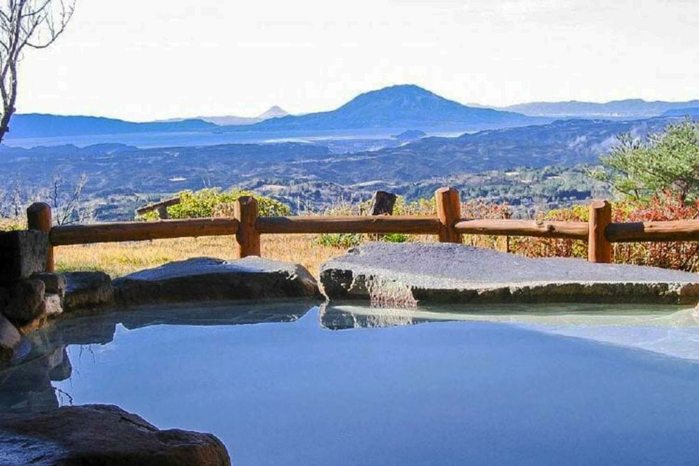
We stayed at the Ryokojin Sanso in Kirishima Onsen, which made for a perfect base for both days of hiking.
- Trekking map
Get your paper map in English at the Kirishima Onsen Visitor Center or download here the Kirishima trekking map in PDF. (external link)
You can find more info about the Geopark on the site of Kirishima Kinkowan National Park (external link).
- GPX track
-
Download the GPX track of Takachihonomine hike in Kirishima, for your maps app or GPS watch.
- Location
-
Kirishima Onsen Open in maps (external link)
- Details
-
Visited Last checked