Mt. Aso's Eboshidake and Kishimadake hike
阿蘇山-烏帽子岳-杵島岳
Two easy hikes up Eboshidake and Kishimadake, with the active Nakadake crater rumbling close by.
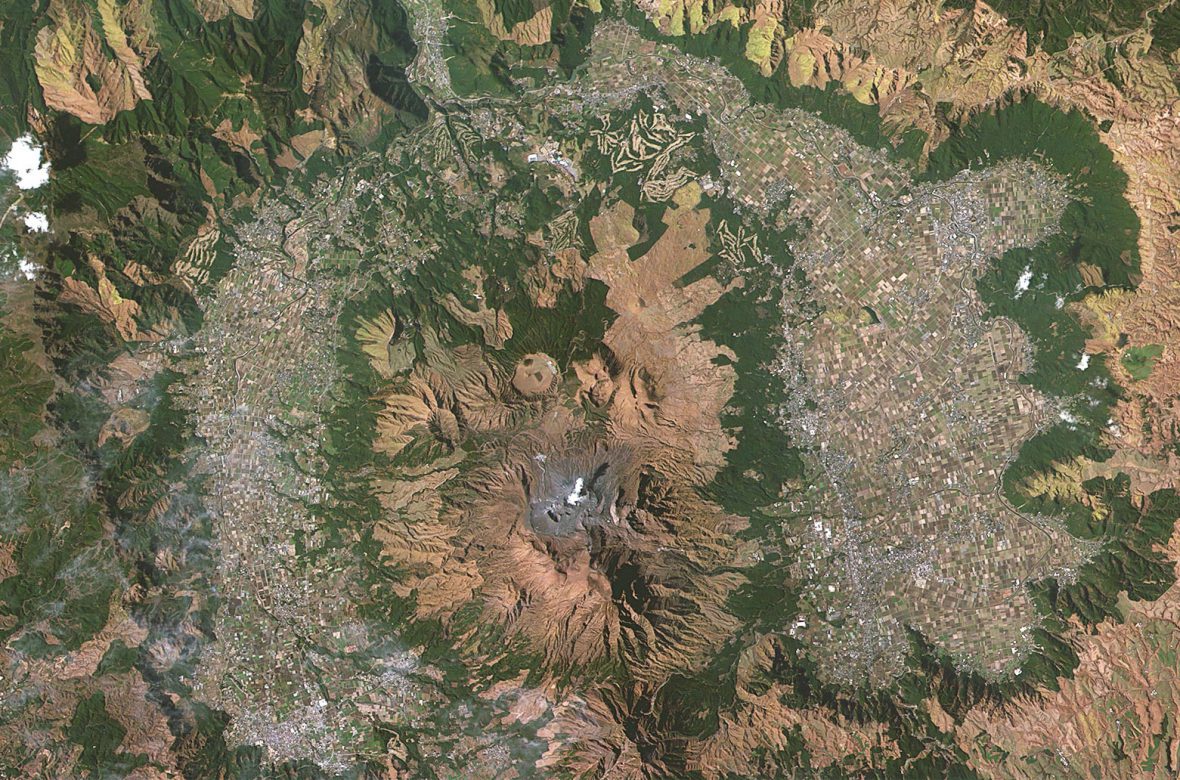
The Aso caldera and its 5 peaks
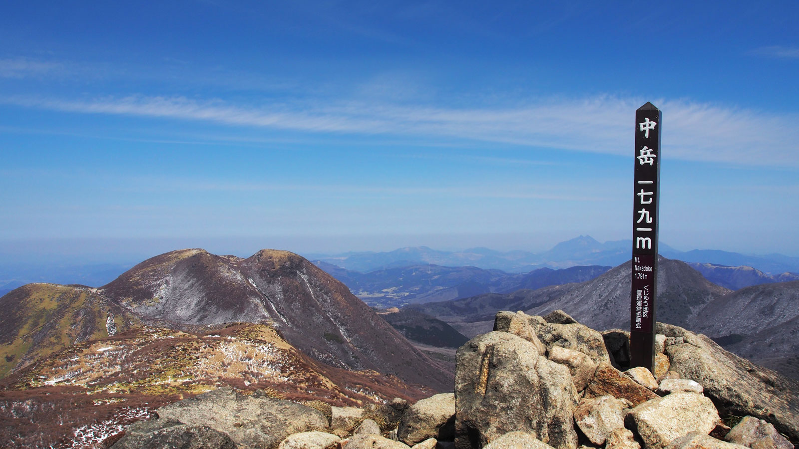
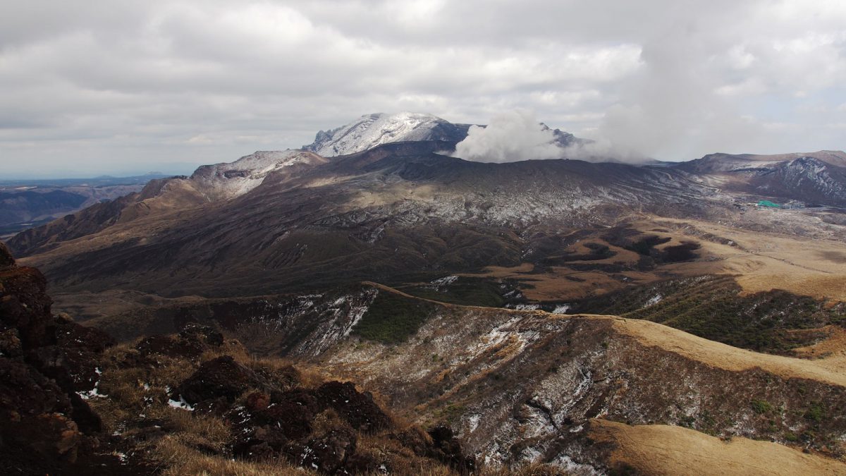
Mount Aso isn't a single mountain but a group of volcanoes inside a vast caldera — one of the largest in the world, covering about 350 km² with a circumference of roughly 100 km. It's part of Aso-Kuju National Park, which spans central Kyushu and also takes in the Kuju mountains. Five peaks rise from the caldera floor: Nakadake 中岳 (1,506 m), Eboshidake 烏帽子岳 (1,337 m), Kishimadake 杵島岳 (1,321 m), Nekodake 根子岳 (1,433 m), and Takadake 高岳 (1,592 m), the highest of the group. Whichever peak you climb, you get the same wide view: the town of Aso in the distance, sitting in the northern part of the caldera, with roads and railway lines looping around the base of the peaks.
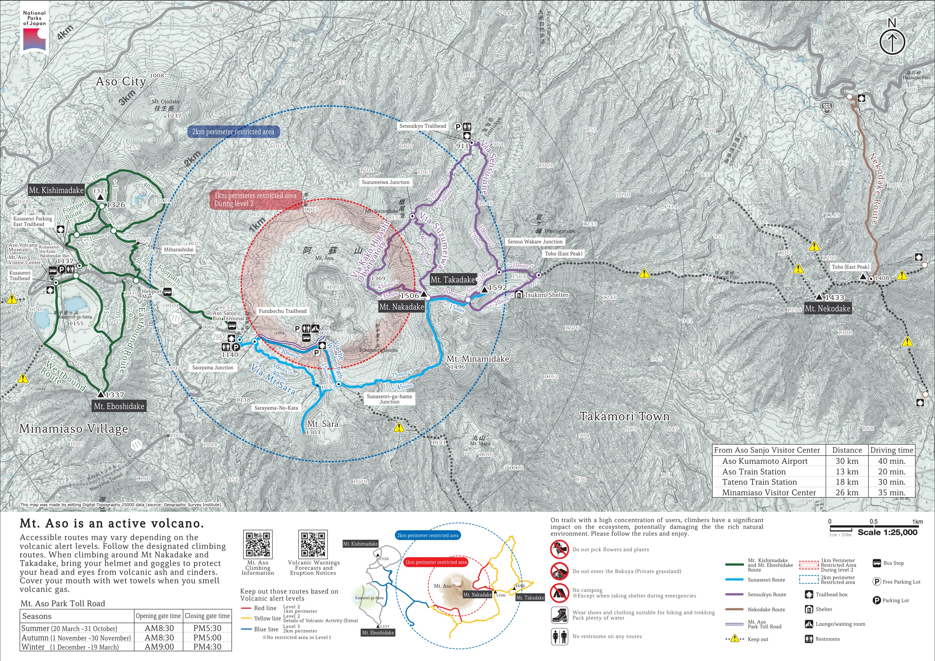
The central crater group can be reached by car or bus, and the hiking trails start at an altitude of around 1,100 m. Routes circle the four main peaks, but Nakadake (the active volcano) and Takadake behind it are often closed off due to volcanic gas and elevated activity — access depends on the daily alert level, so it's worth checking before you go. Nekodake, the fifth peak, has its own separate trailhead further away.
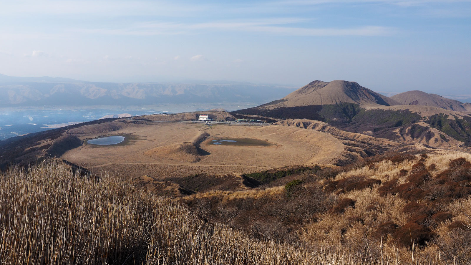
We parked at the main parking lot near Kusasenri (500 yen per day), which is the best starting point for the hikes here. There are shops, toilets, and the adjacent Volcano Museum, though it was closed during our visit because of the pandemic.
Before starting the hike, stop first at the other parking lot — the one by the Nakadake crater. There's an information center there with an English-language hiking map (see image below) showing the approximate times and distances for each trail, worth picking up before you set off.
Eboshidake and Kishimadake hike
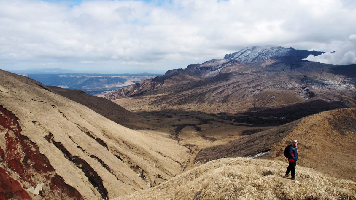
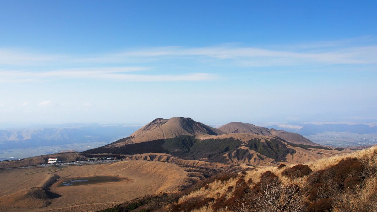
The green routes marked on the map are the two peak loop hikes around Eboshidake and Kishimadake. Together, the two hikes took us 2 hours and were not particularly demanding. The Kusasenri-ga-hama 草千里ケ浜 and Eboshidake loop was the easiest of the two, crossing from one side of the mountain to the other with open views over the Kusasenri grassland and the surrounding caldera.
Kishimadake was a bit more demanding, with some steeper sections, but nothing technical. The paths are clear and well marked throughout. Hiking shoes are worth having, since the trail crosses loose volcanic rock that can be slippery in places.

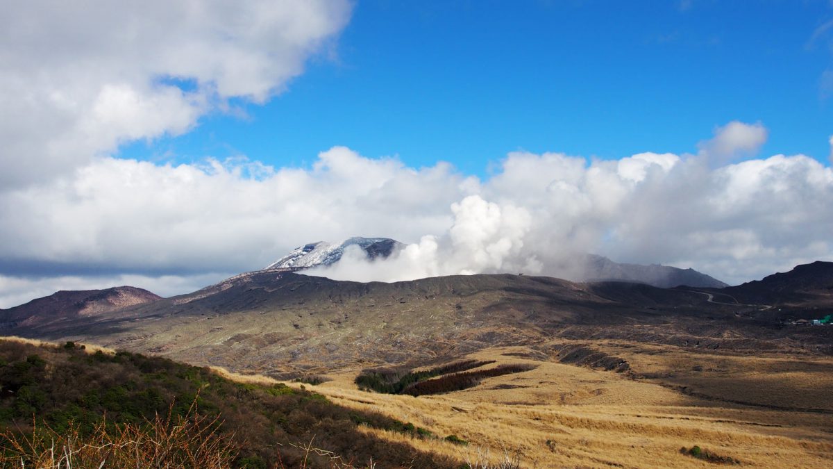
Nakadake crater
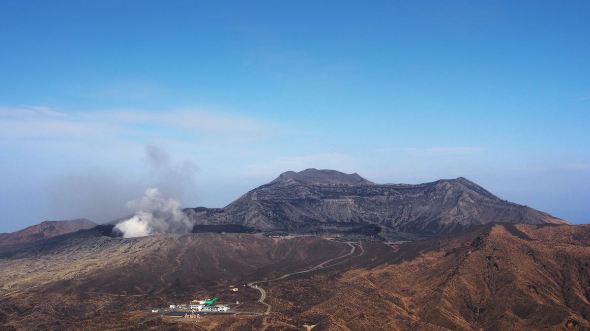
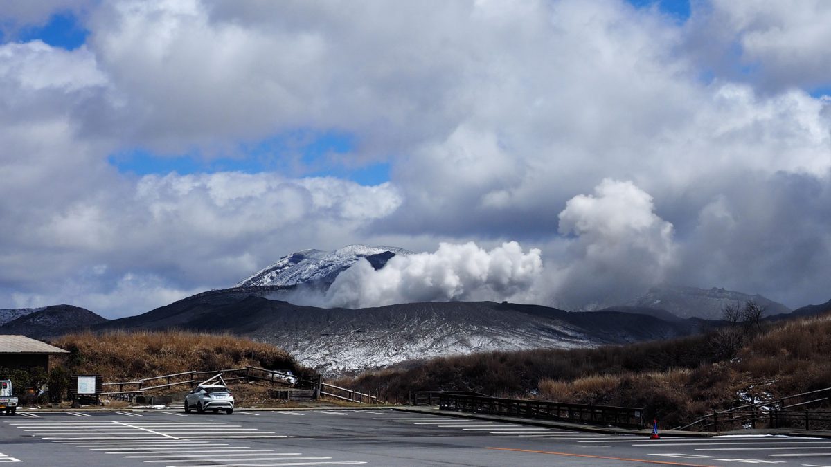
Nakadake has been active since prehistoric times and remains one of Japan's most active volcanoes, with eruptions recorded as recently as 2021. During our visit the crater itself was closed to visitors. Even from a distance, the volcano made an impression: a steady, forceful blast of gas from the crater, accompanied by a deep, continuous rumble that made it feel like it could erupt again at any moment.

Good to know
- Activities
Hiking — pick up the English-language trail map at the Nakadake crater parking lot's information center before setting off; it shows the approximate length and difficulty of each route.
- Getting There
Park at the main lot near Kusasenri (500 yen per day); this is the starting point for the Eboshidake and Kishimadake hikes at around 1,100 m altitude. Shops, toilets, and the Volcano Museum are on site (the museum was closed during our 2020 visit due to the pandemic). Nakadake and Takadake access depends on the volcanic alert level and changes often — check current status before you go.
- Stay
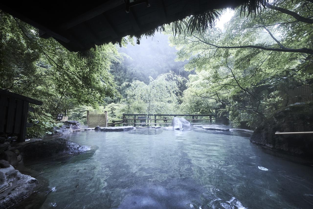
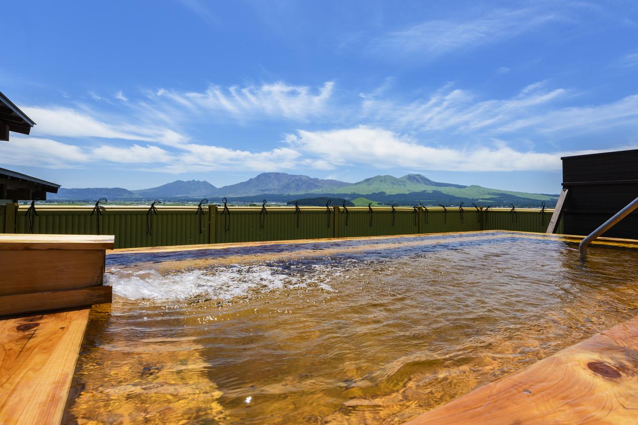
We stayed 2 nights at the Aso Plaza Hotel in Aso town, as part of a 4-day stay around Aso and the Kuju mountains. Mount Aso lies within Aso-Kuju National Park, which spans central Kyushu and includes the Kuju mountains as well. We had a rental car, which made getting around easy.
- Location
-
Aso Open in maps
- Details
-
Visited Last checked