Saiki Onyujima Kyushu Olle walk
大入島
A Kyushu Olle course that crosses Onyujima, a small hilly island in Saiki Bay in eastern Oita, from one ferry pier to the other.
Pier to pier across Onyujima
The walk across Onyujima is part of the Kyushu Olle trail, one of a network of waymarked routes spread across Kyushu and run as a sister trail to Korea's Jeju Olle — gentler than a mountain day, and good at taking you to places you would otherwise drive straight past.
Onyujima sits in Saiki Bay, ten minutes off the mainland: a gourd-shaped island of 5.66 km² with about 17 km of coast and one real hill in the middle. The course brings you by boat to Horikiri, halfway up the island, and finishes at Ishima in the south, where a different boat takes you back to Saiki.
We came in on the morning train and left our bags at the station before walking down to the port. Saiki is a fairly industrial town, a working port of shipyards and cranes.


Scarecrows, mikan and the coast road
The first stretch out of Horikiri runs through the villages, on narrow tarmac between the houses with the water alongside. The scarecrows start almost straight away: life-size cloth figures in real clothes, standing at hedges and gates and sitting on garden walls. One sits on the sea wall in a checked jacket and a cap, holding a bamboo rod over the water.
There is citrus everywhere too. The island grows ponkan, dekopon and lemons on terraces that rise behind the houses, and by early April the trees were heavy with yellow and orange fruit, hanging over the path at head height. The temptation is obvious enough that one orchard gate carries a sign in Japanese, English and Korean asking you to leave it alone: Farmer's Property. Don't make farmers sad. The Korean is no accident, since the whole network was set up with Korean walkers in mind.


Funakakushi and the sea path
The first named landmark, about twenty minutes in, is Funakakushi (舟隠), "boat hiding" — a narrow inlet where boats could be sheltered out of sight. A low concrete embankment crosses it in a straight line, wide enough for one person. The morning we crossed, the water was completely still and reflected the trees and the houses on the far bank.


Up to the Sky Observatory
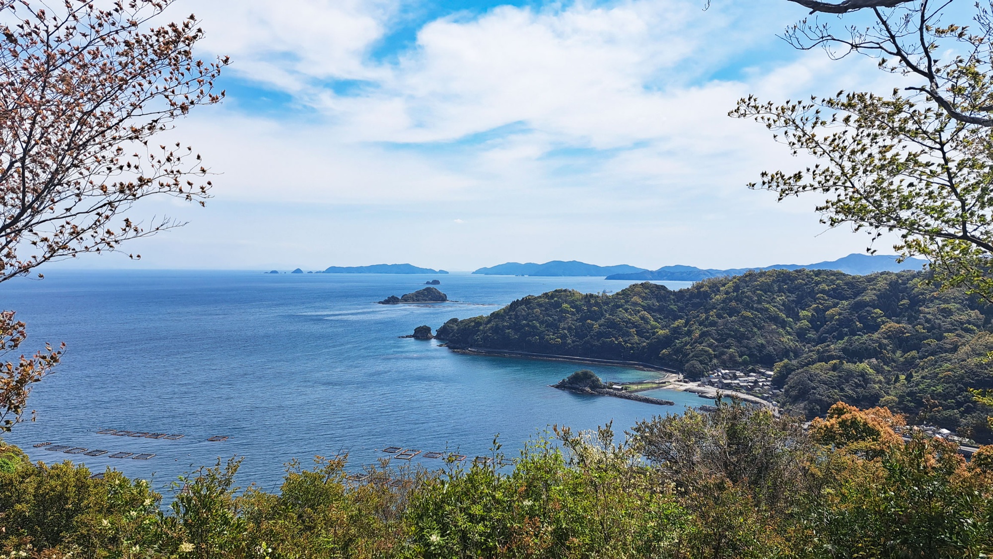
After the coast the route turns uphill into the forest, onto an earth and stone path that is steep in places. This is the way the island's children used to walk over the hill to school. It comes out at the Sky Observatory (空の展望所), a clearing with a view over the bay: the headland, the village roofs and the fish pens offshore.
The path comes back down to sea level at Shirahama, through a short road tunnel cut into the cliff, and goes on to Kangaroo Hiroba, where the course splits. Route A goes over the hill, Route B follows the shore. We took A.


Mount Tomi, and down to Ishima
Route A climbs again, past a village shrine with a stone torii and a straw rope, cherry in blossom over the steps, up to the observatory on Mount Tomi (遠見山), "far-view mountain", 193.5 m and the highest point on the island. The view runs the full circle: Saiki and its shipyard on one side, the inlets and small islands of the bay on the other, and the mountains of the Oita coast behind.
From the top the path drops steeply through the forest into Ishima, the last village, a few minutes from the ferry slip. We met no other walkers all day, only islanders; one of them came out to us with water, a drink and some snacks. The course runs directly through their gardens and orchards, which probably explains both the signs and the hospitality.


After the walk
The boat back to Saiki takes a few minutes and lands within walking distance of the station. We had time before the train to Oita and ate at a small husband-and-wife ramen shop by the station: simple and filling. Saiki has its own ramen style, so it is worth eating a bowl here rather than waiting until Oita.


Good to know
- Getting there
- To Saiki — JR Nippō line. The port is a 10-minute walk from the station; coin lockers there.
- Out — Jōei-maru marine bus (passengers only) to Horikiri, where the course starts.
- Back — Onyujima car ferry, Ishima to Saiki. Cash on board.
- Sailings have been cut back since our visit. Check the timetable first — there is no other way off the island.
- Toilets along the course, vending machines in the villages, no shops after Horikiri.
- Route & difficulty
- Official — 10.5 km, 3–4 hours, intermediate to advanced. Opened March 2018.
- Our track — 10.86 km, 396 m ascent, 2 h 40 min moving.
- Two short forest climbs; the rest is village tarmac and coast road.
- The split at Kangaroo Hiroba, 2.5 km from the finish either way — Route A over Mount Tomi, Route B at sea level and signed for families and older walkers.
- Waymarking & stamps
- Blue and red ribbons, painted and wooden arrows, kanse horse-head markers.
- Signs romanise the island as "Ohnyujima".
- Passports at Onyujima Shokusaikan by Horikiri pier. Stamps there (9:00–17:00, closed Wednesdays) and at Ishima port.
- Season
We walked it in early April: cherry in blossom, citrus still on the trees, warm but not hot. The two climbs are in forest; the village and coast stretches have no shade.
- Where to eat in Saiki
Hakuryū (ラーメン白龍) — 佐伯市駅前1-4-15, a minute from the station. Husband-and-wife shop doing NEO Saiki ramen: pork-bone and chicken broth, heavy on garlic and pepper. 11:40–14:00 and from 18:00, closed Thursdays. Oita prefecture write-up (external link).
- Official links
- GPX track
-
Download the GPX track of Saiki Onyujima Kyushu Olle walk, for your maps app or GPS watch.
- Location
-
Saiki, Oita Open in maps (external link)
- Details
-
Visited Last checked