Nakadake and Kuju mountain range hike from Makinoto pass
くじゅう連山
Open ridges, sweeping peak views and mountains that glow with colour.
Kuju Mountain range
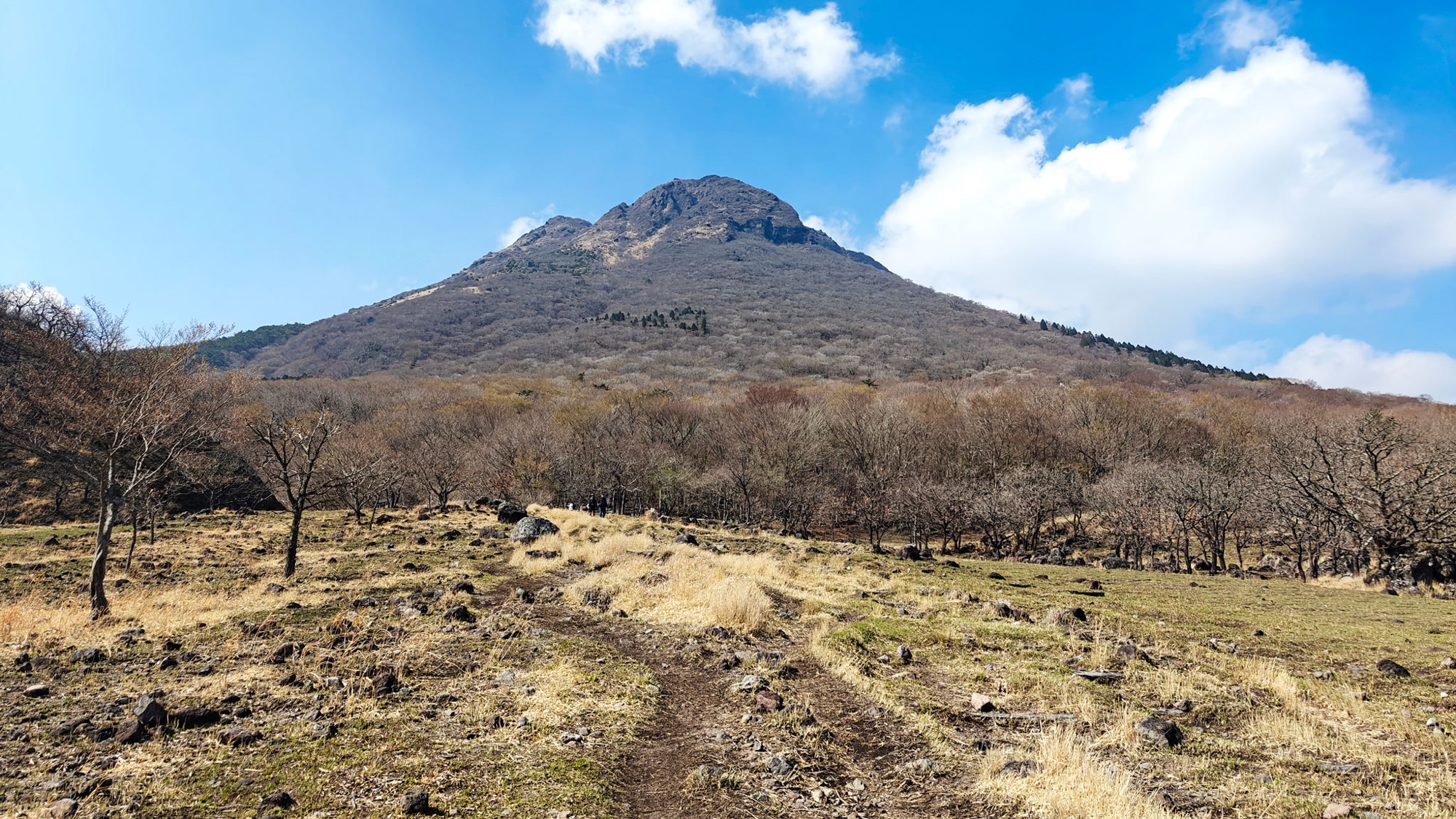
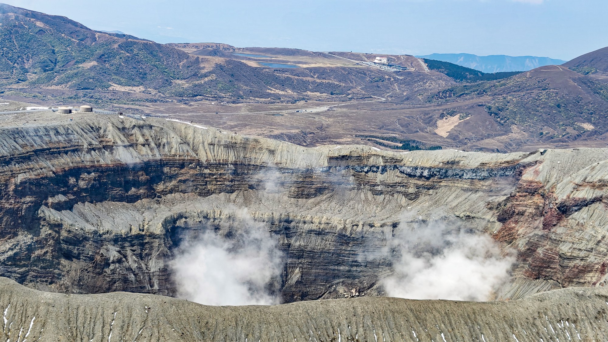
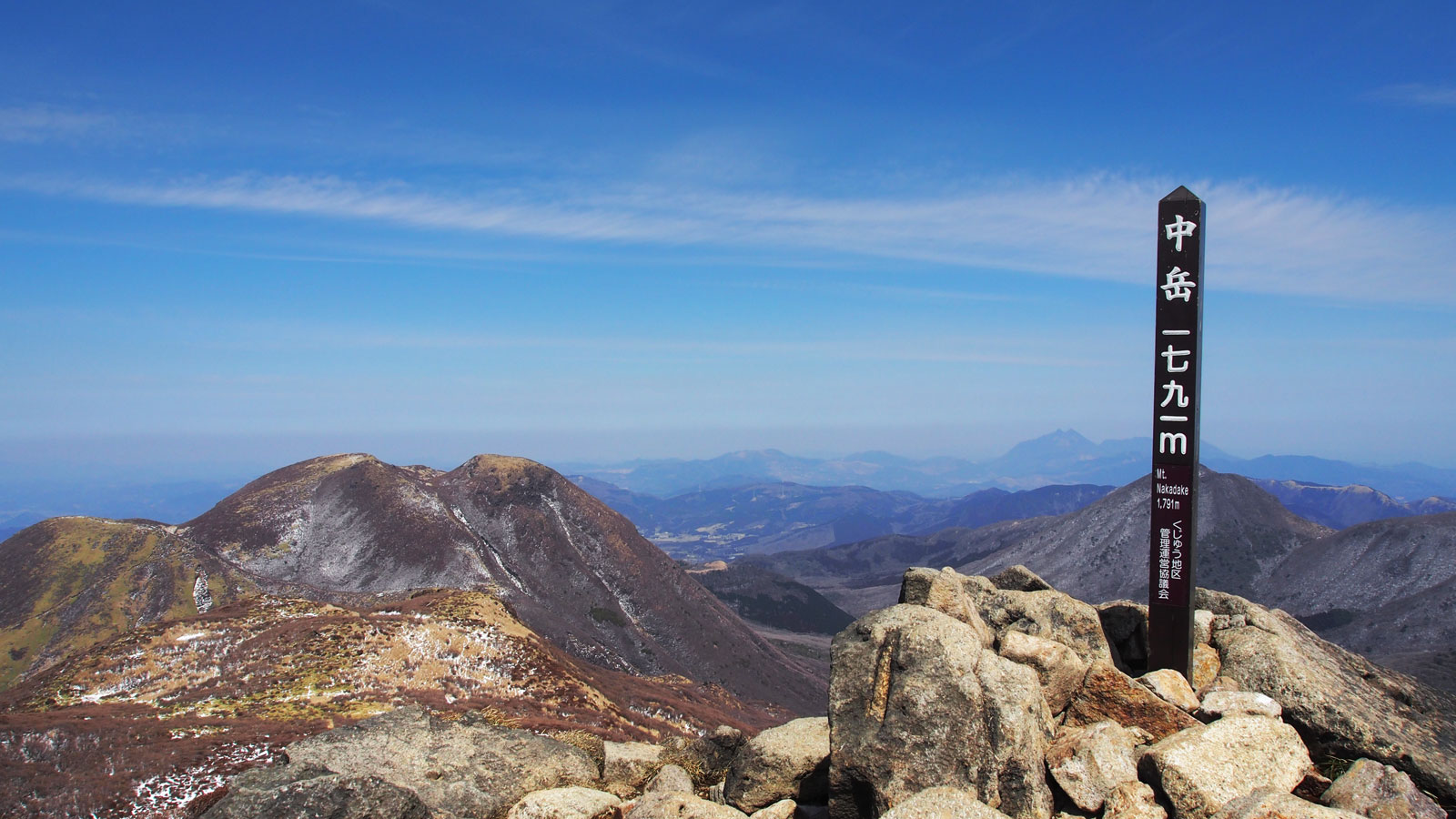
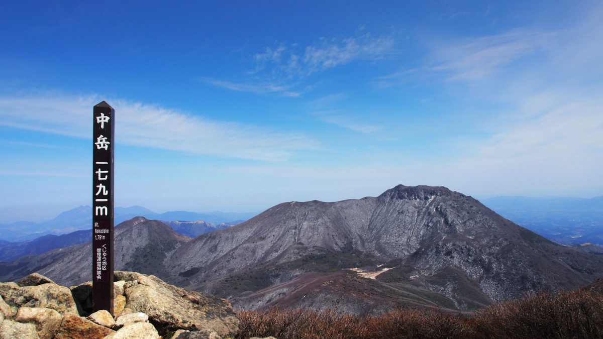
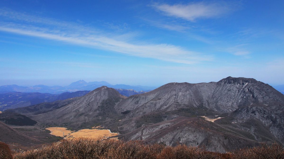
The Kuju mountain range sits within Aso-Kuju National Park and is home to the highest peak in Kyushu: Nakadake 中岳 at 1,791 m. Not to be confused with the other Nakadake — the active crater in Aso — this one is a proper hiking destination with a vast network of trails at all levels.
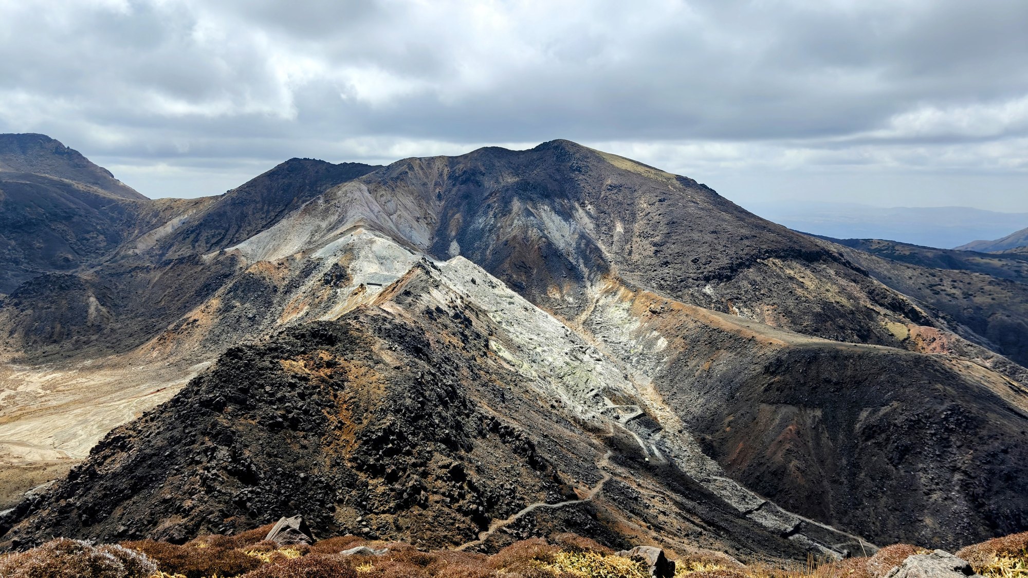
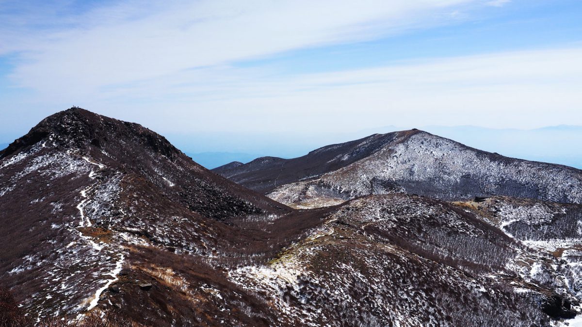
Where Aso is defined by its dramatic caldera and the spectacle of volcanic activity, Kuju is quieter and more spread out. There is no single dominant peak to focus on — instead, a cluster of summits sits close together, all reachable on the same day, with open ridgelines connecting them. The landscape feels wide and exposed in a way that Aso, with its crater walls, does not.
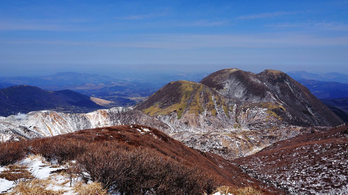
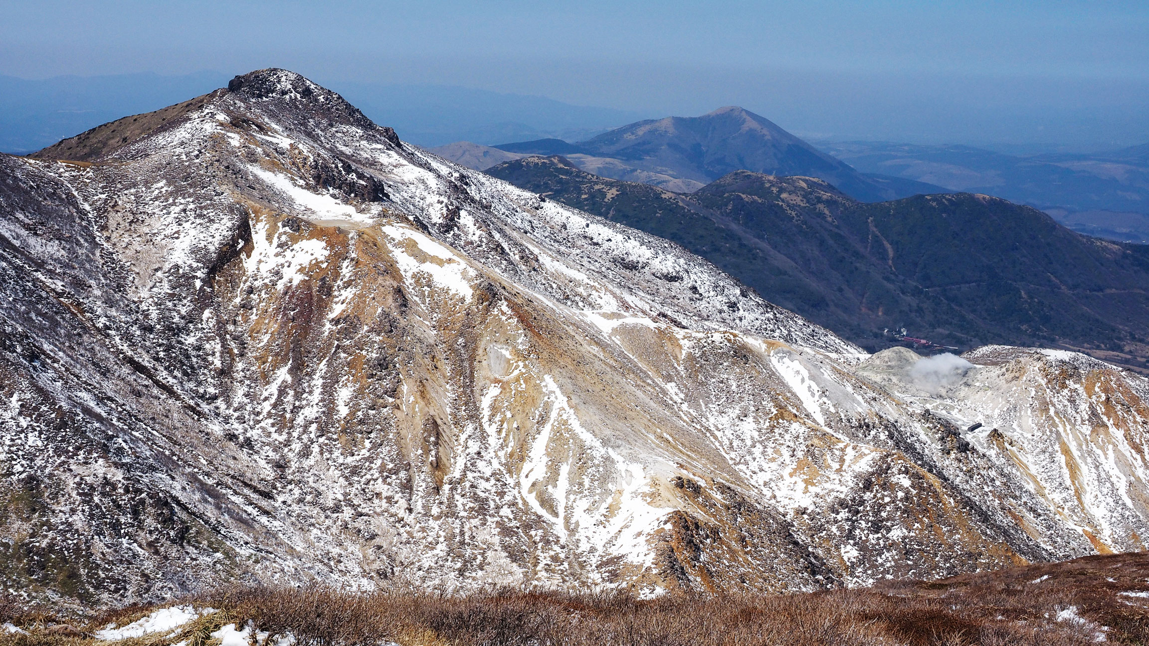
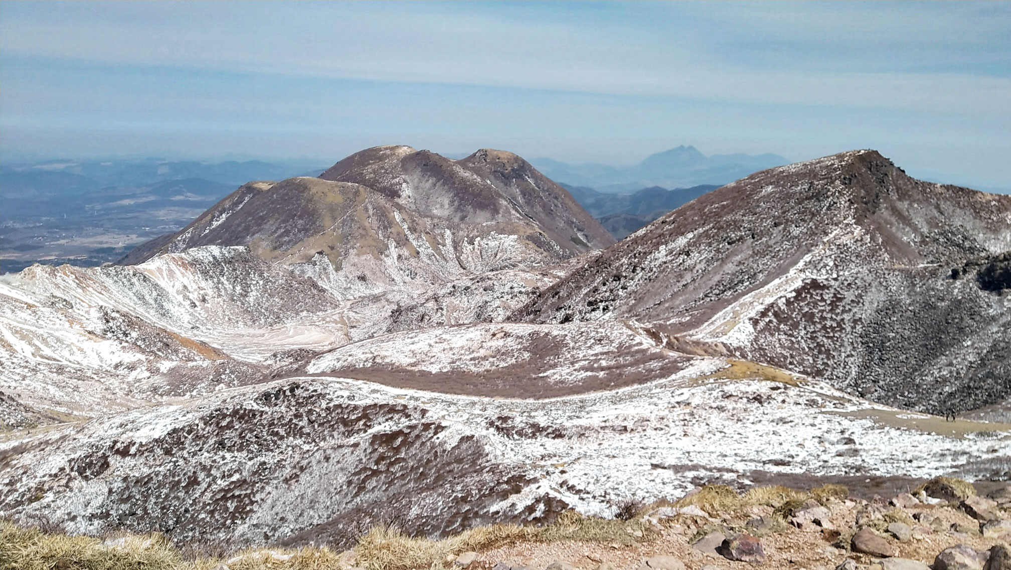
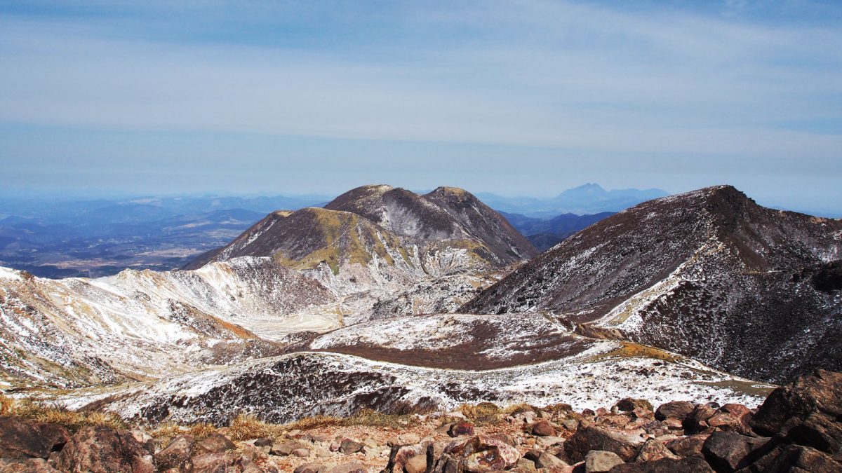
What makes Kuju visually distinctive is its vegetation. The low shrubs and grasses that cover the slopes give the mountains an unusual palette, ranging from light yellow to deep orange, that intensifies in autumn but is striking even in early spring. The volcanic fumes are subtle here — a distant reminder that you are still in the same national park — but it is the colours and the panoramic views across all the surrounding peaks that stay with you.
Makinoto pass to Nakadake
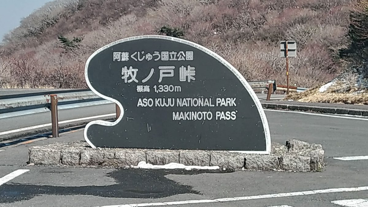
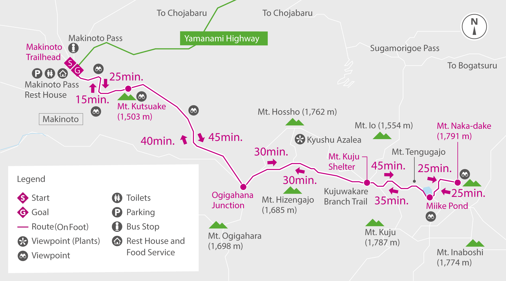
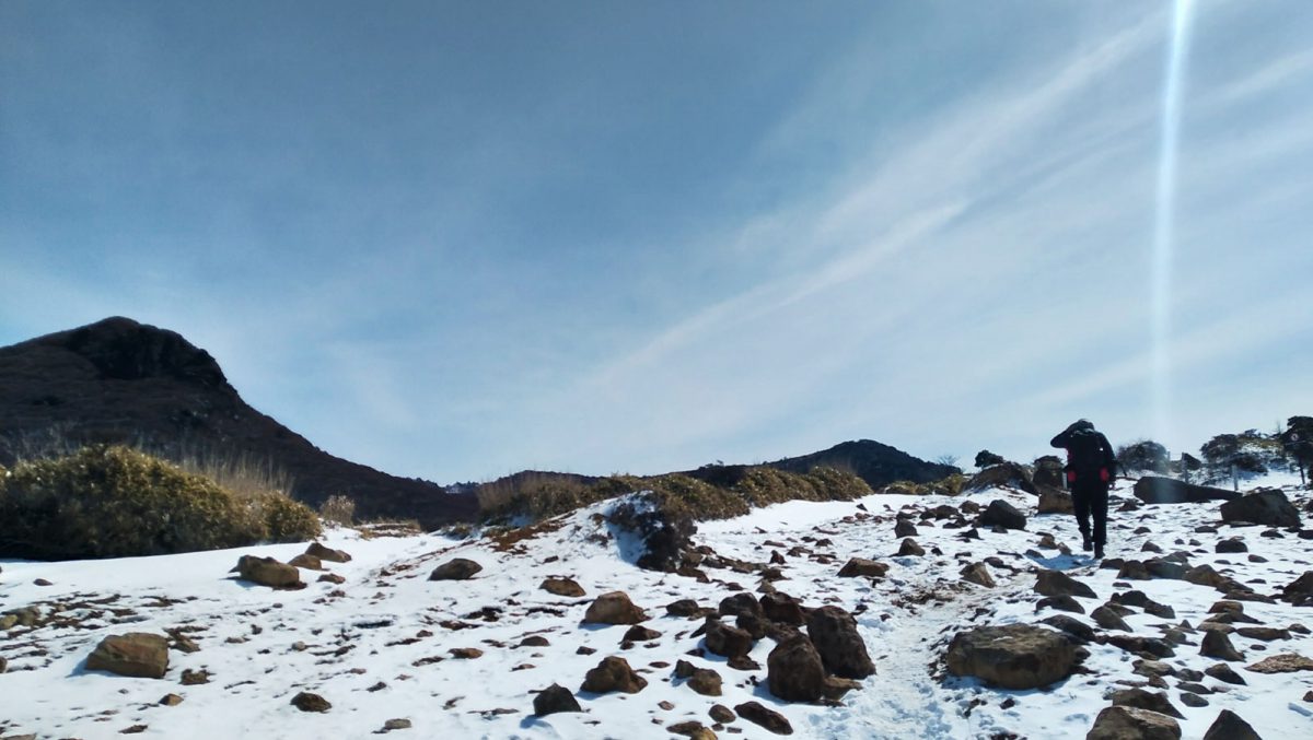
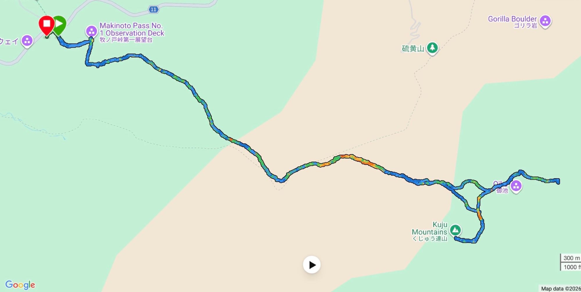
We parked at the Makinoto trailhead (external link), starting at 1,330 m. The trail begins with stairs and paved stretches through trees and forest before opening up to rocky paths with wide, unobstructed views. In the distance, wisps of volcanic fume rise from some of the flanks.
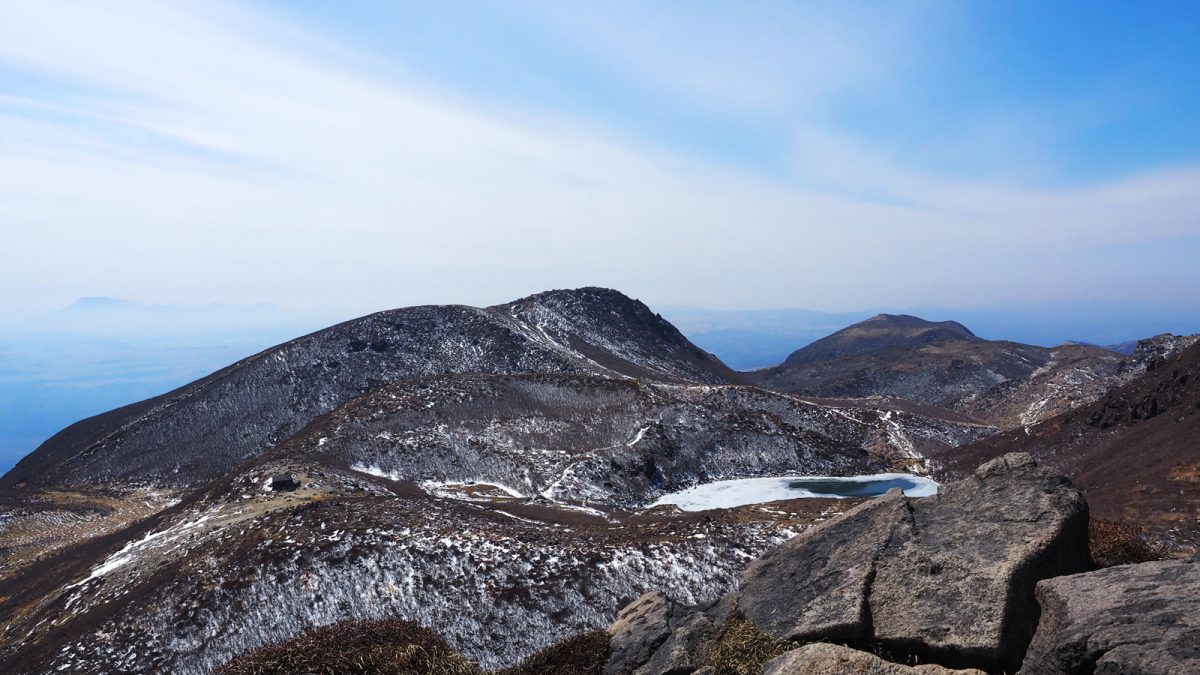
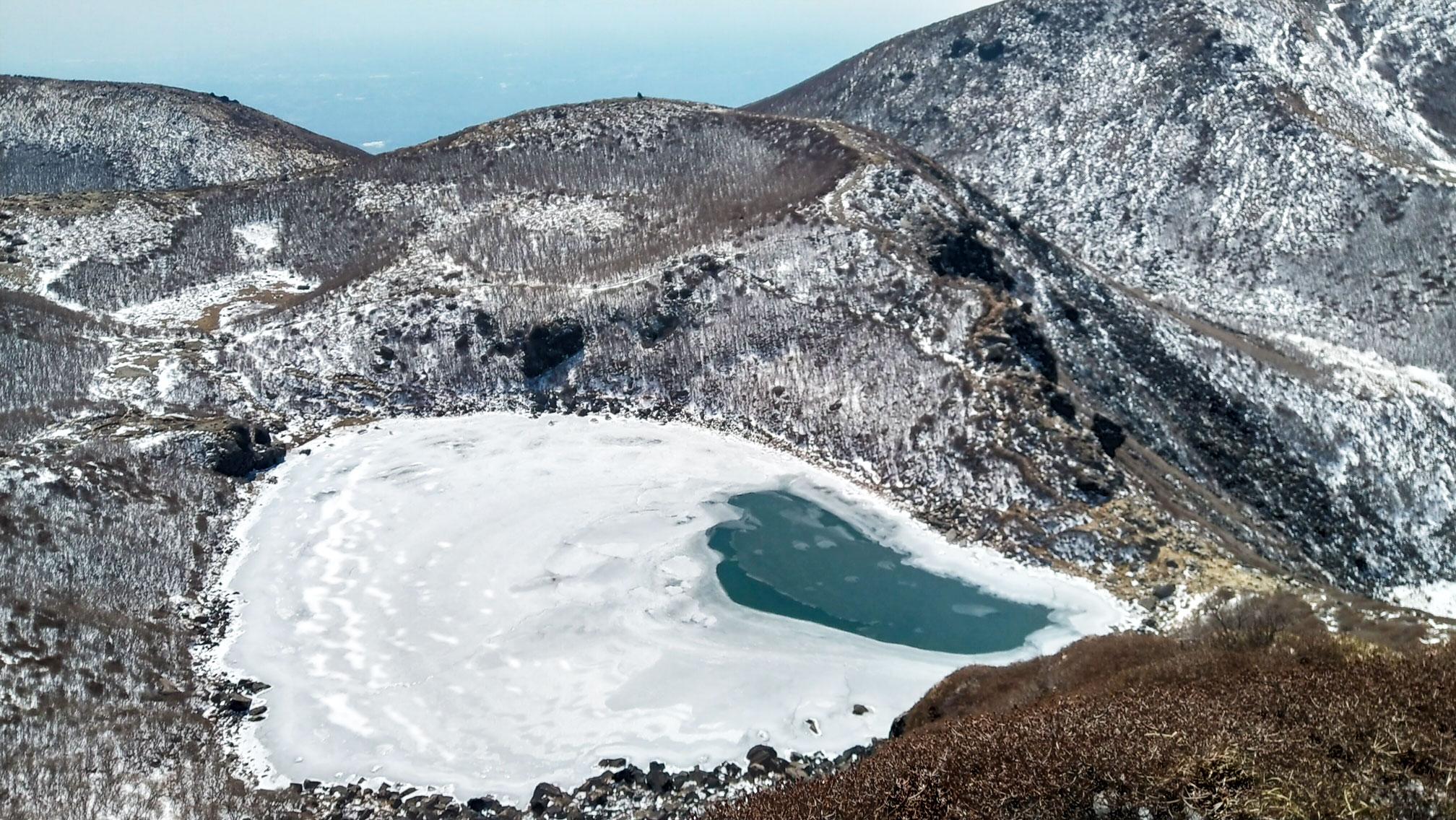
We were there in March, with snow still covering parts of the route and temperatures well below comfortable. The day was sunny and clear, which made all the difference. The full trail is 11 km with around 800 m of elevation gain and took us about 5 hours. Near the summits there is some light rock climbing, and a few sections have loose stones — take care on the way down.
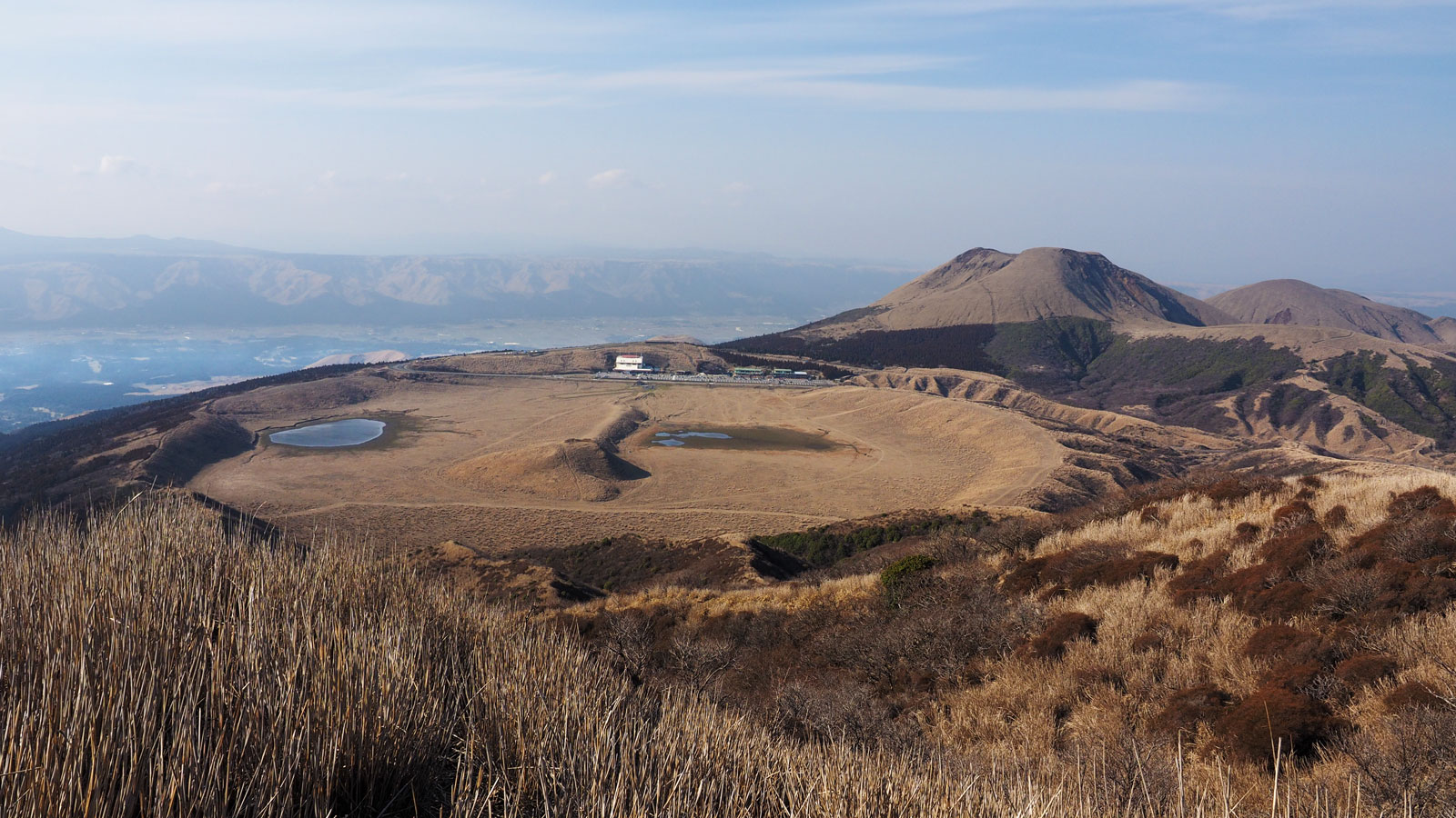
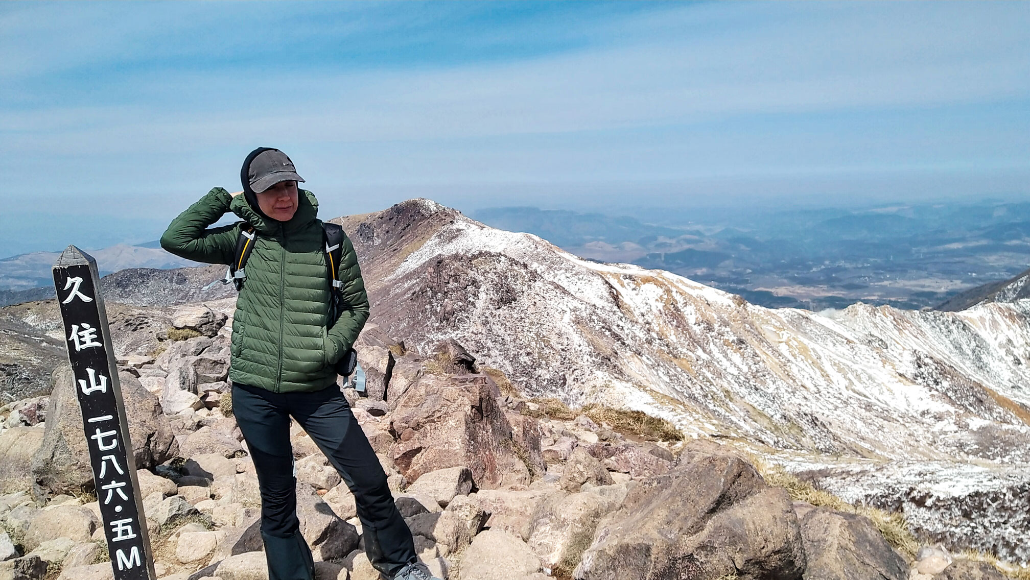
On the way to Nakadake we made a short detour from the main trail and tagged a few extra summits: Tengugajo 天狗ヶ城 at 1,780 m and Kujiusan 久住山 at 1,786 m, each with rewarding views in all directions. The Oike pond, partly frozen in March, is visible from all the high points along the route.

Good to know
- Food
The Makinoto Pass Resthouse at the trailhead has a toilet and a small shop with mountaineering supplies, coffee and souvenirs. That said, stock up on onigiri or other food at a supermarket before heading out — we bought ours in Kurokawa Onsen the evening before so we could make an early start. Don't forget water.
- Stay
We spent four days in the area and also visited Mount Aso, which is part of the same national park. Two nights at the Aso Plaza Hotel in Aso and two nights at Okunoyu (external link) in Kurokawa Onsen.
- links
- GPX track
-
Download the GPX track of Nakadake and Kuju mountain range hike from Makinoto pass, for your maps app or GPS watch.
- Location
-
Kuju, Kumamoto Open in maps (external link)
- Details
-
Visited Last checked